
What is recorded here
From the National Monuments Service (Archaeological Survey of Ireland) record CO095-078
Places near here
Photo credits
- Maker not stated on source page, www.alamy.com
- Maker not stated on source page, commons.wikimedia.org
- Maker not stated on source page, www.pinterest.com
- Maker not stated on source page, www.dreamstime.com
- National Inventory of Architectural Heritage
- Maker not stated on source page, www.geograph.ie
- Maker not stated on source page, en.wikipedia.org
 Fairy fort / earthen ringfort in Belrose LowerFairy fort / earthen ringfort · 823 yd
Explorer Tom Ringfort in Belrose Lower has an underground passage inside it, so the fairies can get really lost down there. The rest…
 Mapped cemeteryCemetery · 935 yd
Explorer Tom Mapped cemetery in County Cork has a secret talent for making you feel like you’re intruding on a private conversation…
 CastleCastle, unclassified · 971 yd
Explorer Tom Castle in Castletown belonged to the McCarthys of Gleannacroim before Cromwell’s soldiers torched it all down. Now…
 Radial-stone enclosure in Kilnacranagh WestRadial-stone enclosure · 1142 yd
Explorer Tom Radial-stone enclosure in Kilnacranagh West looks like someone left their knitting half-finished on the bank. Fourteen…
Fairy fort / earthen ringfort in Belrose UpperFairy fort / earthen ringfort · 1284 ydExplorer Tom Ringfort in Belrose Upper has a blocked entrance and cultivation ridges crossing the middle. Someone farmed right…
 Fairy fort / earthen ringfort in Castletown (carbery East (w.d.) By.)Fairy fort / earthen ringfort · 1337 yd
Explorer Tom Castletown By.) in County Cork is acting very mysterious. The account says small upright boulders form the facing…
 Castlelands HouseHouse · 1.0 mi
Explorer Tom Castlelands House in Castlelands has a secret talent for doing absolutely nothing while looking very important. It’s a…
 Castle (Site of)Castle, Anglo-Norman masonry castle · 1.2 mi
Explorer Tom Castle in Castlelands (carbery East (w.d.) By.), County Cork is just a rock outcrop with a commanding view and no…
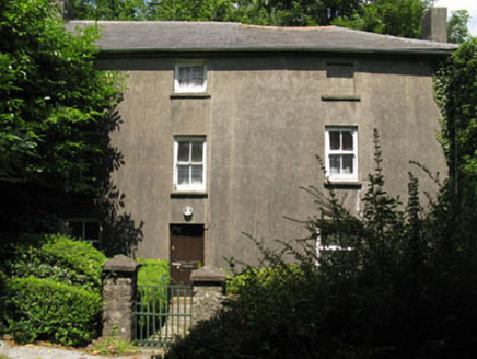 Castlelands MillMill (water) · 1.3 mi
Explorer Tom Castlelands Mill is a former water mill from 1790 that’s now just a house with a past. It’s part of an old milling…
 Church in RushfieldChurch · 1.5 mi
Explorer Tom Church in Rushfield was saved by a hero nobody remembers, probably a guy named Steve who just happened to be walking…
 Mount LodgeHouse · 1.6 mi
Explorer Tom Mount Lodge in Derrigra looks small because it’s sitting on a raised basement. Built around 1820 as a villa for…
 St. Mary's GAA pitchGAA ground · 1.8 mi
More archaeology and monuments in County Cork · All of County Cork

What do you know about this place?Tap to add a comment or ask a question