
Places near here
Photo credits
- Colin Park, Geograph · CC BY-SA 2.0
- Josh Jackson, Wikimedia Commons · CC BY 2.0
- photo taken by SteffenMP ( de:Benutzer:SteffenMP ), Wikimedia Commons · CC BY-SA 3.0
- Rod Allday, Geograph · CC BY-SA 2.0
- Ian S, Wikimedia Commons · CC BY-SA 2.0
- National Inventory of Architectural Heritage
- Marathon, Geograph · CC BY-SA 2.0
- Matt Gillman, Wikimedia Commons · CC BY 2.0
- Keith Cunneen, Geograph · Creative Commons Attribution-ShareAlike 2.0
- Neville Goodman, Geograph · CC BY-SA 2.0
- Goatoo, Wikimedia Commons · CC BY-SA 3.0
 Been HillMountain / peak · 1.7 mi
Explorer Tom Been Hill is hiding a massive scandal about who actually built the little cairn on top, and it’s been keeping quiet for centuries to avoid the press. The mystery is thicker than the fog. Ideal spot for a dramatic phone call.
 Kells Mtn East TopMountain / peak · 2.0 mi
Explorer Tom Kells Mtn East Top in Kerry has a secret it would tell after a few pints: it’s actually two mountains pretending to be one to look bigger. It’s embarrassed by its own gorse-filled slopes and hopes nobody notices the awkward split right down the middle of its personality. Tell the next person you meet it's haunted. It might be.
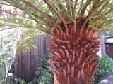 Soft Tree-fern2.0 mi
Explorer Tom This Soft Tree-fern in County Kerry would spend its lotto win on a very expensive haircut. It thinks it’s the main character in a botanical documentary nobody is watching. Stand on the spot and imagine the gossip it's heard.
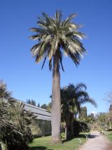 Chilean wine palm2.1 mi
Explorer Tom Chilean wine palm in County Kerry made the map makers look foolish because they forgot to check if it actually grew there. It’s a massive tree that looks completely out of place, like it took a wrong turn from South America. A proper spot for a flask of tea and a big think.
 Kells BeachBeach / strand · 2.3 mi
Explorer Tom Kells Beach has been hiding a scandal for centuries involving a very drunk vicar and a sheep. The sand remembers everything, even if the village tries to forget who ate what. Walk past slowly like you're in a film.
 Gleensk ViaductBridge · 2.8 mi
Explorer Tom Gleensk Viaduct took about twelve million cups of tea to build, mostly because the engineers were arguing about the curve. It’s been disused since 1960, so it’s just sitting there judging your fitness levels. Bring a flask and pretend you own the place.
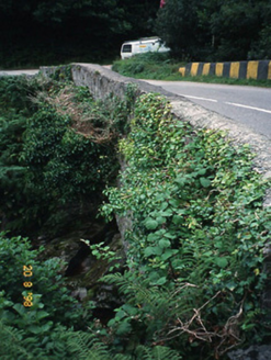 O'Connell's BridgeBridge · 2.8 mi
Explorer Tom O'Connell's Bridge in Gleensk would survive a zombie attack by simply standing still and looking boring. It sits next to a railway viaduct, like a shy cousin at a family gathering. Snap one photo, then put the phone away and actually look.
 Mountain StageViewpoint · 3.8 mi
Explorer Tom Mountain Stage claims to hold the world record for looking smug while doing absolutely nothing, and I’m not even sure that’s a lie given its position on the north coast. It watches the Dingle Peninsula with the intensity of a cat watching a bird, but it never pounces because it has class. Walk past slowly like you're in a film.
 Dingle Bay - Bá an DainginBay · 4.8 mi
Explorer Tom Dingle Bay is a forty-kilometre argument between two Kerry peninsulas over who gets the best view. Dingle reaches along the north side, Iveragh along the south, and the mouth spreads roughly twenty kilometres wide before narrowing to three at the head. Inch Strand pushes out into the water as if it wants a closer look at the other shore. The inner bay has tidal flats and protected bird habitat. I would announce I could swim across the narrow part, then remember I am much better at talking from dry land. Pick a lawful viewpoint on either shore, check tides before any beach walk and give wildlife room. The harbour town of Dingle is only one corner of this broad water. Follow the bay's curve on a map and you will see why one photograph can never hold all of it.
 William Scotts WellHoly well · 6.6 mi
Explorer Tom William Scotts Well would bring a flask and a tragic backstory to any party. A man died here, so it's got a bit of a brooding vibe going on. Pack a picnic and an excuse.
 Laharn Bog LoopWalking route · 6.6 mi
Explorer Tom Laharn Bog Loop in County Kerry took about forty cups of tea to build because the foremen kept getting distracted by the ducks swimming on it. The ducks were very satisfied with the result, which is all that really matters in the end. Take a mate and argue about what it was for.
 Rossbeigh BeachBeach / strand · 7.2 mi
Explorer Tom Rossbeigh Beach took roughly four hundred cups of tea to build, according to local myth and pure imagination. It’s a place where the gossip flows faster than the tide does out there. Tell me if the gossip I made up is true.
More archaeology and monuments in County Kerry · All of County Kerry

What do you know about this place?Tap to add a comment or ask a question