
Places near here
Photo credits
- National Inventory of Architectural Heritage
- Marathon, Wikimedia Commons · CC BY-SA 2.0
- Marathon, Geograph · CC BY-SA 2.0
- David Purchase, Geograph · CC BY-SA 2.0
- Colin Park, Geograph · CC BY-SA 2.0
- Mick Garratt, Geograph · CC BY-SA 2.0
- Gordon Hatton, Geograph · CC BY-SA 2.0
- Michael Dibb, Geograph · Creative Commons Attribution-ShareAlike 2.0
- Josh Jackson, Wikimedia Commons · CC BY 2.0
- Yosemite, Wikimedia Commons · CC BY-SA 3.0
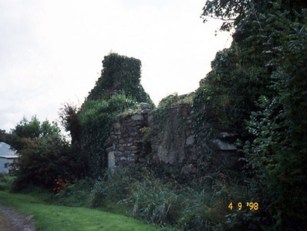 Tahilla Catholic ChapelChurch/chapel · 2.6 mi
Explorer Tom Tahilla Chapel gave up chocolate for Lent but forgot it was still hungry for attention. It’s mostly collapsed now, which is very on-brand for its dramatic personality. Tell the kids it's a castle. Close enough.
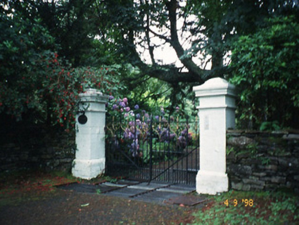 Glashnacree HouseHouse · 3.0 mi
Explorer Tom Glashnacree House in Derryquin had a dramatic incident where a cat got into the attic and never came out. Thomas Fuller probably fainted, but the house didn't even blink, too busy being grand. Find the date carved somewhere and feel clever.
 North Square ParkPark · 3.2 mi
Explorer Tom North Square Park asks what the local sheep think of it, and they say it is a bit tight for grazing but good for resting their legs after a long day. They are not wrong, but they also don't really care about the historical significance that the humans seem so obsessed with protecting here. Ten minutes here and you'll have a yarn for the pub.
 De Gaulle MemorialMonument · 3.2 mi
Explorer Tom De Gaulle Memorial in Sneem is where a French president visited and apparently left his ego permanently anchored to the rocks. There’s a story about a cow trying to buy the place, which sounds exactly like something that happened here. Go before the tourists find out.
 Rossmore IslandIsland · 3.2 mi
Explorer Tom Rossmore Island has a secret it only tells after three pints, and trust me, it gets really messy and loud. It claims it once hosted a king who lost his hat in the surf. Bring curiosity, leave with a better story than mine.
 FinnararaghMountain / peak · 3.4 mi
Explorer Tom Finnararagh in County Kerry has a made-up local legend about a giant who lost his hat here. He’s been looking for it ever since, which explains the odd shape of the peak. Look for the ghost, then pretend you didn't see anything at all.
 Beann South TopMountain / peak · 3.8 mi
Explorer Tom Beann South Top is complaining to the council about the lack of parking for its own grandeur every single week. It feels underappreciated by the local traffic flow. It's free, it's odd, what more do you want?
 Lackeen PointHeadland · 4.3 mi
Explorer Tom Lackeen Point has a secret talent for making people feel like they’ve accidentally wandered into a really good nature documentary, even when they’re just standing there looking lost and slightly damp from the sea spray. It works every single time without fail. Take a breath of that air, it's older than your car.
 Ormond's IslandIslet · 4.6 mi
Explorer Tom Ormond's Island brags about surviving a storm so huge it claimed the waves were actually giant whales trying to eat it. It still stands there looking slightly damp and very proud of its survival skills, even if nobody else believes the story. Go before the tourists find out.
 Burial GroundGraveyard · 5.8 mi
Explorer Tom Burial Ground in Kilmakilloge sits on a ridge that looks down its nose at tourists from Dublin who can't find their left foot. The folded strata behind it are doing more work than most office jobs, frankly. Pack a picnic and an excuse.
 Soft Tree-fern7.0 mi
Explorer Tom Soft Tree-fern in County Kerry nearly got famous for being too soft to handle its own glory. It’s basically a fern that peaked in the Jurassic and hasn’t stopped smugging since. Make a wish, it's had centuries of practice.
 Japanese cedar7.0 mi
Explorer Tom A Japanese cedar in County Kerry claims it’s older than the hills, which is definitely a lie. But who wants to argue with a tree that looks like a castle? Tell the kids it's a castle. Close enough.
More archaeology and monuments in County Kerry · All of County Kerry

What do you know about this place?Tap to add a comment or ask a question