
What is recorded here
Listed in the RMP for Co. Kerry as an Enclosure, there is however no evidence or references in the paper file to the existence of an enclosure at this location. Therefore the classification has been changed from Enclosure to Standing Stone as this monument was not listed in the Kerry RMP. The Ardcanaght (Aird…
Read the whole record
From the National Monuments Service (Archaeological Survey of Ireland) record KE047-026
Places near here
Photo credits
- Maker not stated on source page, www.tripadvisor.ca
- Maker not stated on source page, edmooneyphoto.wordpress.com
- Maker not stated on source page, uk.pinterest.com
- Maker not stated on source page, en.wikipedia.org
- Maker not stated on source page, tr.pinterest.com
- Maker not stated on source page, commons.wikimedia.org
- National Inventory of Architectural Heritage
- Maker not stated on source page, za.pinterest.com
- Andreas F. Borchert, Wikimedia Commons · CC BY-SA 4.0
- Kmcnamee, Wikimedia Commons · CC BY-SA 4.0
- Maker not stated on source page, www.dailymail.co.uk
- Maker not stated on source page, electricbluefood.com
 Ogham stone (present location) in ArdcanaghtOgham stone (present location) · 1 yd
Explorer Tom Ogham stone in Ardcanaght is badly damaged and missing half its bottom, which is rude. The weather has had a long…
 Ogham stone in ArdcanaghtOgham stone · 372 yd
Explorer Tom This broken Ogham stone in Ardcanaght would teach history if it had to, but it's too tired. It only remembers half the…
 CastleCastle, unclassified · 731 yd
Explorer Tom Castle in Ardcanaght is hiding behind Slievelogher because a bishop refused to visit and it’s still holding a grudge…
 Fairy fort / earthen ringfort in Rathpoge EastFairy fort / earthen ringfort · 1694 yd
Explorer Tom Fairy fort / earthen ringfort in Rathpoge East nearly got famous once, but the paperwork got stuck in the archive for…
 Enclosure in FarnaEnclosure · 1713 yd
Explorer Tom Enclosure in Farna was built on a bargain where someone promised to name it after their uncle, but then forgot which…
 Fairy fort / earthen ringfort in Boolteens East,boolteens WestFairy fort / earthen ringfort · 1.1 mi
Explorer Tom Fairy fort / earthen ringfort in Boolteens East, Boolteens West hides a treasure that is definitely just a rusty…
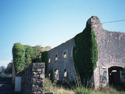 store/warehouse1.1 mi
Explorer Tom The ruined corn store in Meanus thinks the road leading to it is a personal insult because it’s so bumpy. It’s all red…
 Fairy fort / earthen ringfort in Boolteens WestFairy fort / earthen ringfort · 1.2 mi
Explorer Tom Fairy fort / earthen ringfort in Boolteens West had a fox take charge of the security detail last Tuesday. The fox is…
 Killagh Abbey (in ruins)Religious house, Augustinian canons · 1.4 mi
Explorer Tom Killagh Abbey thinks it’s the main character in a medieval drama, complete with a fan club that dissolved centuries…
 Páirc de Búrca, Milltown/CastlemaineGAA ground · 1.4 mi
 White Church GraveyardGraveyard · 1.4 mi
Explorer Tom White Church Graveyard in County Kerry seems to have wandered into the wrong postcode entirely, like a lost dog with a…
 Graveyard in Kilcolman (trughanacmy By.)Graveyard · 1.4 mi
Explorer Tom Graveyard in Kilcolman has no details, so I invented one: it once ordered chips and a pint for every resting soul. It’s…
More archaeology and monuments in County Kerry · All of County Kerry

What do you know about this place?Tap to add a comment or ask a question