
Places near here
Photo credits
- National Inventory of Architectural Heritage
- Corkonian2013, Wikimedia Commons · CC BY-SA 3.0
- Frederick Dean, Geograph · CC BY-SA 2.0
- Sole Origami, Wikimedia Commons · CC BY-SA 4.0
- Jo and Steve Turner, Geograph · CC BY-SA 2.0
- Hywel Williams, Wikimedia Commons · CC BY-SA 2.0
- David P Howard, Geograph · CC BY-SA 2.0
- Jonathan Thacker, Geograph · Creative Commons Attribution-ShareAlike 2.0
- Mike Searle, Wikimedia Commons · CC BY-SA 2.0
- Jonathan Thacker, Wikimedia Commons · CC BY-SA 2.0
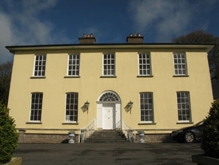 Aghavrin HouseHouse · 937 yd
Explorer Tom Aghavrin House is so symmetrical it makes me dizzy, with chimneystacks that look like they're trying to punch the sky. If it talked to its younger self, it would say 'stop slouching, we have grandeur to maintain.' Get in there and bow.
 Mullinhassig WoodWood · 1293 yd
 Mullinhassig WaterfallWaterfall · 1446 yd
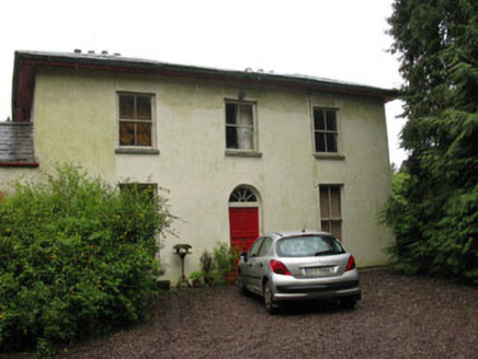 Rock LodgeHouse · 1.1 mi
Explorer Tom Rock Lodge in Coolacullig was once ruled by a goat named Gerald who demanded cheese and respect. The house has overhanging eaves that look like they’re trying to fly away from responsibility. Go in good book shape; Gerald’s ghost still checks your spine!
Carrigadrohid Castle InfoVisitor information · 2.0 mi Carrigadrohid CastleHeritage attraction · 2.0 mi
 Carrigadrohid Castle (in Ruins)Castle, tower house · 2.0 mi
Explorer Tom Carrigadrohid Castle is standing in water because someone decided to build a dam nearby. It's basically an island now, which is very dramatic. The MacCarthys built this back in the fifteenth century, so it's seen some stuff!
 St Olans WellHoly well · 2.3 mi
Explorer Tom St Olans Well is surrounded by stone and votive offerings, making it look a bit like an ancient jewelry box. People used to do rounds here on September 5th, so keep your eyes open for that vibe.
 Farran WoodWood · 3.5 mi
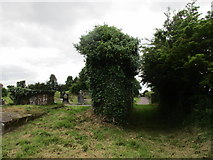 Grave YardGraveyard · 3.6 mi
Explorer Tom Graveyard in Aglish sits on a ridge, watching the Lee valley while pretending it isn’t also a church ruin. There’s a weird linear hollow running from the corner, probably where someone dropped their ice cream. Bring your own legend, I've run out.
 Castlemore CastleCastle · 4.8 mi
Explorer Tom Castlemore Castle in County Cork is just a name on a map and a picture file. No details, no drama. Be cheeky and take a photo for me if you can find anything more than the words 'Castle More' in your head.
 Kilcrea FriaryGraveyard · 6.1 mi
More archaeology and monuments in County Cork · All of County Cork

What do you know about this place?Tap to add a comment or ask a question