
Places near here
Photo credits
- Ceoil ( talk ) ( Uploads ), Wikimedia Commons · Public domain
- National Inventory of Architectural Heritage
- Jonathan Thacker, Geograph · Creative Commons Attribution-ShareAlike 2.0
- Kmcnamee, Wikimedia Commons · CC BY-SA 4.0
- me, Wikimedia Commons · Public domain
- Maker named on the Wikimedia Commons picture page · CC BY-SA 2.5
- Joebater at English Wikipedia, Wikimedia Commons · CC BY-SA 3.0
- Jim Woodward-Nutt, Wikimedia Commons · CC BY-SA 2.0
- A.-K. D., Wikimedia Commons · CC BY-SA 4.0
- Alison Cassidy, Wikimedia Commons · CC BY-SA 4.0
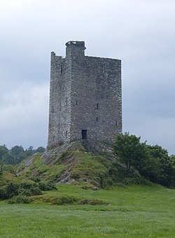 Carrigaphooca Castle (in ruins)Castle, tower house · 1535 yd
Explorer Tom Carrigaphooca Castle sits on a rocky outcrop like a king on a throne. The MacCarthys built it back in 1436, which is…
Carrigaphooca CastleCastle · 1536 ydExplorer Tom Carrigaphooca Castle has a púca in its name and a rock under its feet, enough for me to spin a tale before we even…
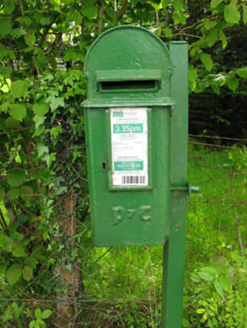 post box1.0 mi
Explorer Tom Post box in Lackaneen is still doing its job from 1930, wearing raised Gaelic script like a very proud hat. It’s a…
 Carrigaphooca BridgeBridge · 1.1 mi
Explorer Tom Carrigaphooca Bridge has six arches and looks like it’s been rendered to hide its age since 1820. It used to be on the…
 Páirc Uí Chuana, Cill na MartraGAA ground · 1.7 miClondrohid GAA pitchGAA ground · 1.8 mi
 The Gearagh Nature ReserveNature reserve · 2.9 mi
Explorer Tom The Gearagh Nature Reserve remembers the time a priest lost a bet there and had to wear a penguin suit for a week…
 Sessile Oak3.5 mi
Explorer Tom Sessile Oak in County Cork would post on social media: 'Another day, another leaf falling. #NatureIsIndifferent.' It’s…
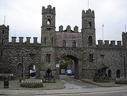 Battle of MacroomBattle · 3.9 mi
Explorer Tom The Battle of Macroom is constantly trying to one-up its more famous cousin next door by claiming it had better weather…
 Bealick MillVisitor attraction · 4.6 mi
Explorer Tom Bealick Mill would teach history like a strict teacher who only uses one-liners and expects you to already know the…
 CairnCairn, unclassified · 4.8 mi
Explorer Tom St Abbán’s grave at An Tseanchluain is guarding some ogham stones like a grumpy gatekeeper. It’s got a bullaun on top…
 St Gobnets WellHoly well · 5.3 mi
Explorer Tom St Gobnets Well is the final stop on a pilgrimage and has heard every 'Ave' and 'Gloria' since the dawn of time, so…
More archaeology and monuments in County Cork · All of County Cork

What do you know about this place?Tap to add a comment or ask a question