What is recorded here
On level patch of pasture on S-facing slope overlooking Clodagh river. Row of three stones, alighed NE-SW, 3.5m in overall length. NE stone leans markedly to SE; it is 0.7m L, 0.25m T and when upright, would be 0.7m H. Next stone, 0.35m to SW, is 0.7m L, 0.3m T and 1.1m H. SW stone, 0.9m from last, is 0.9m L, 0.7m T and 0.95m H. (Ó Nualláin 1988, 236, no. 49).
From the National Monuments Service (Archaeological Survey of Ireland) record CO119-029
The monument record does not grant public access. Check the route and ask the landowner before entering private land.
- What survives
- Recorded monument
Places near here
Photo credits
- Graham Horn, Geograph · CC BY-SA 2.0
- Mike Searle, Wikimedia Commons · CC BY-SA 2.0
- Ernest Riordan, Geograph · CC BY-SA 2.0
- Neville Goodman, Geograph · CC BY-SA 2.0
- National Inventory of Architectural Heritage
- Graham Horn, Geograph · Creative Commons Attribution-ShareAlike 2.0
- Mac McCarron, Geograph · Creative Commons Attribution-ShareAlike 2.0
- Draceane, Wikimedia Commons · CC BY-SA 4.0
- Maker named on the Wikimedia Commons picture page · CC BY-SA 3.0
- Colin Park, Geograph · CC BY-SA 2.0
- Dr Brian Lynch, Geograph · CC BY-SA 2.0
 Castle Donovan (in Ruins)Castle, tower house · 1.5 mi
 Castle DonovanCastle · 1.5 mi
 Nowen Hill sw TopMountain / peak · 1.6 mi
 Milane HillMountain / peak · 1.9 mi
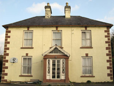 Rockmount HouseHouse · 2.3 mi
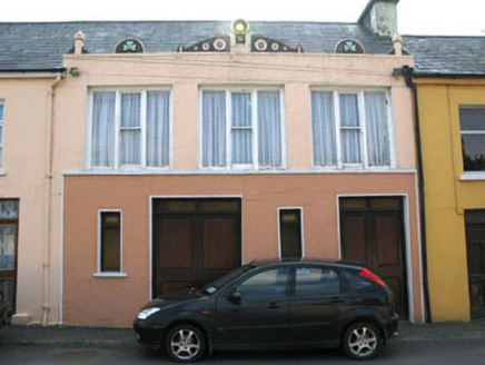 shop/retail outlet2.3 mi
 Caheragh Burial GroundGraveyard · 4.7 mi
 Graveyard7.4 mi
 Chilean myrtle9.8 mi
 Dawn Redwood10.0 mi
 The Priests LeapViewpoint · 12 mi
 Ballydehob's 3-Arch Road BridgeVisitor information · 13 mi
More archaeology and monuments in County Cork · All of County Cork
What do you know about this place?