
What is recorded here
From the National Monuments Service (Archaeological Survey of Ireland) record CO060-143
Places near here
Photo credits
- Maker not stated on source page, mademoiselleruta.com
- Maker not stated on source page, it.pinterest.com
- National Inventory of Architectural Heritage
- Sole Origami, Wikimedia Commons · CC BY-SA 4.0
- Kmcnamee, Wikimedia Commons · CC BY-SA 4.0
- Maker not stated on source page, www.pinterest.com
 Church (Site of)Church · 1090 yd
Explorer Tom Church in Leadawillin is in a field named Chapel Field, next to a rock outcrop called Donnell's little rock. The site…
 Fairy fort / earthen ringfort in Knockglass (muskerry East By.)Fairy fort / earthen ringfort · 1225 yd
Explorer Tom Fairy fort / earthen ringfort in Knockglass is planning its retirement by slowly dissolving into a nice, flat meadow.…
 Leades HouseCountry house · 1481 yd
Explorer Tom Leades House is a small country house with big dreams and tall windows. The symmetrical chimneys are doing their best…
Fairy fort / earthen ringfort in Curraghawaddra (muskerry East By.)Fairy fort / earthen ringfort · 1.0 miExplorer Tom Fairy fort / earthen ringfort in Curraghawaddra is hiding under conifer trees and a man-made tunnel. A 1997 inventory…
 St John the Baptist Roman Catholic ChurchChurch/chapel · 1.2 mi
Explorer Tom St John the Baptist Roman Catholic Church in Kilberrihert is keeping it simple and barn-like. Built around 1800, it’s…
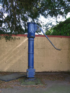 water pump1.2 mi
Explorer Tom Water pump in Rusheen lost its cap but keeps its curved handle. It’s been disused for a bit now, opposite the school.…
 Aghinagh GAA pitchGAA ground · 1.2 mi
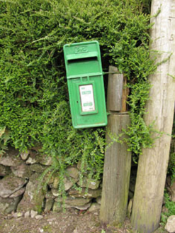 post box1.3 mi
Explorer Tom Post box in Inchaleagh is a little cast-iron guy from 1950 standing opposite the church. It’s got Celtic Revival…
 St John the Baptist ChurchOfficially recorded historic building · 1.3 mi
Explorer Tom St John the Baptist Church was nearly sold for a horse because someone thought the pinnacles were decorative horse…
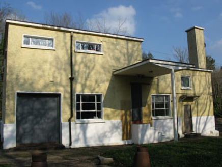 Rusheen CreameryCreamery · 1.4 mi
Explorer Tom Rusheen Creamery was built in 1962 to prove cows have style, which is debatable. It stopped milking in 1982 but kept…
 Dolmen (Remains of)Standing stone · 1.4 mi
Explorer Tom Dolmen (Remains of) in Rusheen is leaning so far west that it looks like it’s trying to escape the field and run for…
 Historic buildingOfficially recorded historic building · 1.4 mi
Explorer Tom This historic building in Rusheen is made of corrugated iron, which means it sounds like a drum when it rains and…
More archaeology and monuments in County Cork · All of County Cork

What do you know about this place?Tap to add a comment or ask a question