
Places near here
Photo credits
- National Inventory of Architectural Heritage
- Ceoil at English Wikipedia, Wikimedia Commons · CC BY-SA 3.0
- User Coil00 on en.wikipedia, Wikimedia Commons · CC BY-SA 3.0
- Michael Earnshaw, Geograph · CC BY-SA 2.0
- Kmcnamee, Wikimedia Commons · CC BY-SA 4.0
- Jonathan Thacker, Wikimedia Commons · CC BY-SA 2.0
- Ceoil ( talk ) ( Uploads ), Wikimedia Commons · Public domain
- Joebater at English Wikipedia, Wikimedia Commons · CC BY-SA 3.0
- Jim Woodward-Nutt, Wikimedia Commons · CC BY-SA 2.0
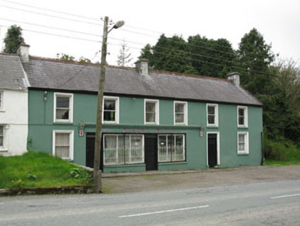 Edmond WalshHouse · 1.6 mi
Explorer Tom Edmond Walsh in Carriganimmy hosted a dance where someone stepped on the floor and it broke, so now it’s both a shop…
 St John the Baptist Roman Catholic ChurchChurch/chapel · 1.7 mi
Explorer Tom St John the Baptist Church in Carriganimmy is modest but has stained glass that’ll blow your mind. It’s been renovated…
 KnocknakillaArchaeological place · 2.5 mi
Explorer Tom Knocknakilla sits high on the north-west slope of Musherabeg Mountain, where a five-stone circle, standing stones and a…
 Glantane EastArchaeological place · 2.9 mi
Explorer Tom Glantane East in County Cork has a favourite song that only the wind can hear properly. It's been singing the same tune…
 MusheramoreMountain / peak · 2.9 mi
Explorer Tom Musheramore rises above Kilcorney in the Boggeragh Mountains, a Cork hill with enough open sky to make a modest walker…
 Clondrohid GAA pitchGAA ground · 3.1 mi
 MusheraMountain / peak · 3.8 mi
Explorer Tom Mushera claims to be older than the concept of time itself, which is a stretch even for a mountain. I say it’s just old…
Aghinagh GAA pitchGAA ground · 4.6 mi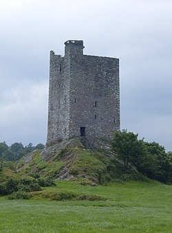 Carrigaphooca CastleCastle · 4.7 mi
Explorer Tom Carrigaphooca Castle has a púca in its name and a rock under its feet, enough for me to spin a tale before we even…
Carrigaphooca Castle (in ruins)Castle, tower house · 4.7 miExplorer Tom Carrigaphooca Castle sits on a rocky outcrop like a king on a throne. The MacCarthys built it back in 1436, which is…
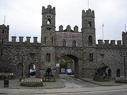 Battle of MacroomBattle · 5.1 mi
Explorer Tom The Battle of Macroom is constantly trying to one-up its more famous cousin next door by claiming it had better weather…
 Bealick MillVisitor attraction · 5.4 mi
Explorer Tom Bealick Mill would teach history like a strict teacher who only uses one-liners and expects you to already know the…
More archaeology and monuments in County Cork · All of County Cork

What do you know about this place?Tap to add a comment or ask a question