What is recorded here
G. Yd. is a living graveyard on the Owenboy estuary where Carrigaline buries its dead beside a church rebuilt in 1823. Stone walls hold chest tombs, a vault, and headstones reaching back to 1690, while Lady Susanna Newenham’s altar tomb faces the entrance like a keeper of the place. The church rose again on an older sacred site, and the graveyard continues to accept what the town lets go.
On N shore Owenboy estuary, on S side of road; rectangular area (c. 50m E-W; c. 80m N-S) enclosed by stone wall; still in use, recent extension on W side. Inscribed headstones date from 1690 (O'Leary 1918, 120-1), also a number of chest tombs (O'Leary ibid.; Coleman 1904-6g, 18-20); large gabled burial vault SE of church. Facing entrance to graveyard, SW of church, altar tomb of Lady Susanna Newenham, dated 1754, set in vaulted shelter; burial place of Newenham family of Coolmore house (CO087-043---) (Coleman ibid., 18). At centre, St. Mary's C of I church (CO087-036003-): nave and chancel with spired tower at W end; built in neo-Gothic style in 1823 to design of Pain brothers, brass tablet above door inscribed: "Jas. &G: R: PAIN/ ARCHts/ 1823"; N transept added in 1835 (Brady 1863, vol. 1,63; Lewis 1837, vol. 1, 278). On site of ancient parish church (CO087-036002-) of Carrigaline, described in 1700 as 'above 70 foot long....well slated and well furnished with seats' (Lunham 1909, 169-70); O'Leary (ibid.) notes 'detached stone' bearing inscription "this church was rebuilt in the year of our saviour Christ, 1723"; Smith (1750, vol. 1, 208) described it as 'in decent order'; no visible surface trace. Font (CO087-142----) dated 1637 inside church.
The above description is derived from the published 'Archaeological Inventory of County Cork. Volume 2: East and South Cork' (Dublin: Stationery Office, 1994). In certain instances the entries have been revised and updated in the light of recent research.
Date of upload/revision: 14 January 2009
The monument record does not grant public access. Check the route and ask the landowner before entering private land.
- What survives
- Recorded monument
Places near here
 Font in Carrigaline MiddleFont · 14 yd
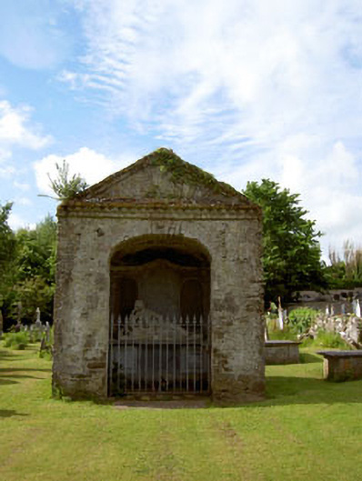 Saint Mary's Church (Carrigaline)mausoleum · 23 yd
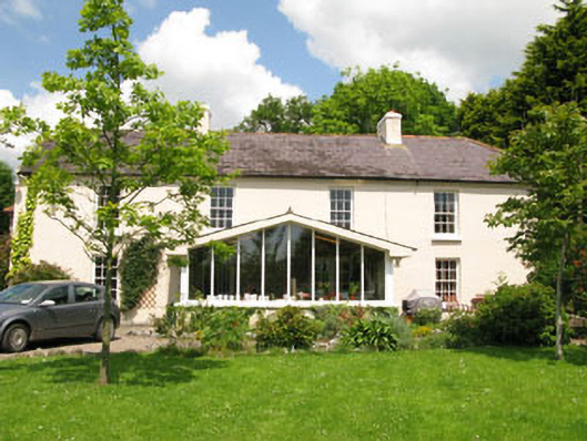 Rock Househouse · 251 yd
 Cogan's CastleCastle · 322 yd
 Man-made underground passage in Carrigaline EastMan-made underground passage · 552 yd
 Castle (in Ruins)Castle, tower house · 1.9 mi
 Coolmore WoodWood · 2.0 mi
 Pauper's GraveyardArchaeological place · 3.0 mi
 Fountainstown BeachBeach / strand · 3.9 mi
 Mulcon ValleyWood · 4.0 mi
 Wildlife and plant information boardsVisitor information · 4.7 mi
 Grey GalleryGallery · 4.8 mi