What is recorded here
At W end of Upper Aghada village; roughly triangular graveyard (c. 80m E-W; c. 60m N-S) with ruined C of I parish church of Aghada (CO088-03502-), on or near site of earlier parish church, to N of centre. In occasional use with recent extension to W. Inscribed headstones date from 1711; one inscription is in Irish (Power 1940, 16); numerous 19th and 20th century headstones (Coleman and Healy 1901-3).
From the National Monuments Service (Archaeological Survey of Ireland) record CO088-035001
The monument record does not grant public access. Check the route and ask the landowner before entering private land.
- What survives
- Recorded monument
Places near here
Photo credits
- National Inventory of Architectural Heritage
- David P Howard, Geograph · CC BY-SA 2.0
- Greg Clarke, Wikimedia Commons · CC BY 2.0
- Guliolopez, Wikimedia Commons · CC BY-SA 3.0
- Peter Craine, Wikimedia Commons · CC BY-SA 2.0
- Arco Ardon from Dordrecht, Netherlands, Wikimedia Commons · CC BY 2.0
- derek menzies, Wikimedia Commons · CC BY-SA 2.0
- Andrew Wood, Geograph · CC BY-SA 2.0
- Guliolopez, Wikimedia Commons · CC BY-SA 4.0
- Jonathan Thacker, Geograph · CC BY-SA 2.0
- Honourablemencandiffer, Wikimedia Commons · Public domain
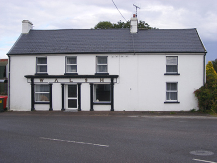 WalshHouse · 70 yd
 J. WalshShop/retail outlet · 141 yd
 Marloag WoodsWood · 1.7 mi
 Camden FortFortification · 3.4 mi
 Camden Fort MeagherHeritage attraction · 3.4 mi
 Heritage CentreMuseum · 3.9 mi
 HaulbowlineIslet · 3.9 mi
.jpg/250px-Rocky_Island_(geograph_3666538).jpg "Photo: derek menzies, Wikimedia Commons · CC BY-SA 2.0") Rocky IslandIslet · 3.9 mi
Rocky IslandIslet · 3.9 mi Church Bay BeachBeach / strand · 4.1 mi
 Martello Tower4.1 mi
 Curraghbinny WoodsForest · 4.2 mi
 Myrtleville BeachBeach / strand · 5.1 mi
More archaeology and monuments in County Cork · All of County Cork
What do you know about this place?