
Places near here
Photo credits
- National Inventory of Architectural Heritage
- A.-K. D., Wikimedia Commons · CC0
- Darrin Antrobus, Wikimedia Commons · CC BY-SA 2.0
- Miguel Angel Masegosa Martínez, Wikimedia Commons · CC BY 2.0
- Mike Searle, Geograph · CC BY-SA 2.0
- Keith Weller, Wikimedia Commons · Public domain
- Hugh Chevallier, Wikimedia Commons · CC BY-SA 2.0
- kevin higgins, Wikimedia Commons · CC BY-SA 2.0
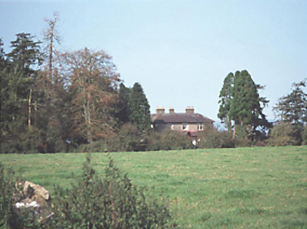 Aghaboe GrangeHouse · 1.6 mi
Explorer Tom Aghaboe Grange is probably rearranging its furniture when nobody’s looking, just to see if you notice the difference. It’s got that Victorian veranda vibe that says 'come in, but mind your manners.' Bring a camera and your most suspicious face.
 Aghaboe MoatCastle, motte and bailey · 1.7 mi
Explorer Tom Aghaboe Moat is basically a medieval speed bump that Strongbow accidentally left behind in 1172. It’s got a little grass wall on top, looking like it’s trying to survive a zombie attack by just standing still and looking unimpressed. Snap one photo, then put the phone away and actually look.
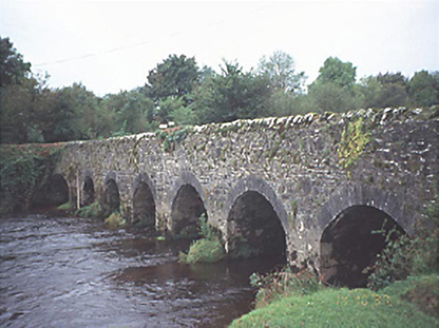 Kilbricken BridgeBridge · 1.7 mi
Explorer Tom Kilbricken Bridge was saved by a hero nobody remembers, probably because he was too busy trying to figure out how seven arches fit over the river Nore without falling in. The triangular cut-waters are doing all the heavy lifting here. Go back in winter, it's a different animal.
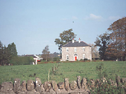 Glebe FarmHouse · 1.7 mi
Explorer Tom Glebe Farm in Keelough was once ruled by a goat named Gerald, I’m pretty sure. It’s a two-storey Georgian house that has seen a lot of history. Ideal for a moody photo you'll pretend wasn't posed.
 Font1.8 mi
Explorer Tom “Font in Aghaboe” hosted a fake royal visit that nobody can prove or deny to this day. It’s octagonal, which is fancy talk for “eight sides.” Spot the oldest stone and give it a name.
 Aghaboe AbbeyVisitor attraction · 1.8 mi
Explorer Tom Aghaboe Abbey in County Laois has a ghost who is too lazy to actually haunt it because the floors are cold. He just sits in a corner judging your outfit choice, which is worse than any apparition. A proper spot for a flask of tea and a big think.
 Sweet Chestnut2.2 mi
Explorer Tom Sweet Chestnut in County Laois is hiding a treasure that is definitely just an old biscuit tin buried under its roots. You’ll dig it up and be disappointed, but worth it. Bring a camera and your most suspicious face.
 St. Fintans WellHoly well · 3.4 mi
Explorer Tom St. Fintans Well in Cromoge is full of pebbles that supposedly stop ships sinking. I say they’re just rocks that got jealous of the ocean. Grab one if you dare, but don’t blame me if your boat capsizes. Sit on a wall near it and pretend you're in a painting.
 Ballygeehin Castle (in Ruins)Bawn · 3.6 mi
Explorer Tom Ballygeehin Castle in Ballygeehin Lower would teach history if it had to, but it’s too busy showing off its moat. It’s basically a giant stone hug for the castle next door. Bring someone who'll believe anything.
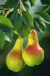 European Pear4.6 mi
Explorer Tom European Pear in County Laois is playing hard to get, much like that cow who tried to buy it with a bad note. It’s probably judging your footwear right now. Ideal stop for a big stretch and a bigger yawn.
 ArderinMountain / peak · 9.4 mi
Explorer Tom Arderin means Ireland's height, which is a cheeky name for a 527-metre hill and exactly the sort of confidence I admire. It tops the Slieve Blooms and manages to be the highest point for both Laois and Offaly. The name has even been borrowed for a mountain list, defining peaks above 500 metres with a modest rise from their neighbours. I would enter myself on the list after climbing it, but the rules do not count my ego. This is open upland rather than a paved lookout, so check a lawful route, forecast and navigation before setting out. Respect working forestry or farmland around the approaches. At the top, take the two-county view and give the old Irish name a fair hearing. A hill need not be enormous to own its place on a map.
 BaunreaghcongMountain / peak · 9.6 mi
Explorer Tom Baunreaghcong in County Laois has a summit pond that looks like it’s trying to drown in its own reflection. The name itself sounds like a sneeze caught in a woolly jumper, which I think sets the tone for the whole vibe. Find the wonkiest bit and send it to your group chat.
More mountains and hills in County Laois · All of County Laois

What do you know about this place?Tap to add a comment or ask a question