DDiscover AloneMapAbout

Friars Well

Well
Computer-made picture that does not show Friars WellNot a photo of this monument
Computer-made picture. It does not show this monument. · Report the wrong picture

What is recorded here

In a low-lying marshy area to the W of the Grey Abbey (KD022-029006-). In the late-1970's, according to Jackson (1979-80, 156), it was not regarded locally as being a holy well. In 2004 and 2005, archaeological test excavation (Licence nos. 04E0233 and 04E0233 ext.) in advance of a proposed large development in the…

Read the whole record
In a low-lying marshy area to the W of the Grey Abbey (KD022-029006-). In the late-1970's, according to Jackson (1979-80, 156), it was not regarded locally as being a holy well. In 2004 and 2005, archaeological test excavation (Licence nos. 04E0233 and 04E0233 ext.) in advance of a proposed large development in the area resulted in two trenches being excavated across the well site. The stratigraphy of the well comprised a 0.1m deposit of topsoil overlying a leached white clay subsoil. Large quantities of modern debris, including metal, glass and plastic, were incorporated into the topsoil. The remains of a wall foundation was identified in the trenches, and fragments of walling were also identified within the well. The excavation followed the course of a naturally eroded streambed, which terminated in the south in the area of the well. Friar’s Well was therefore not a well but a pool at the end of this stream. The ‘well’ was created by defining the western bank of the stream through the construction of a low limestone block wall, which was capped with flagstones. The ‘well’ could not be relied on as a water source, for, as seen through the excavation even in winter, it only occasionally retained water and over a three-month excavation period was predominantly a dry feature. The wall would therefore have functioned to define the water source to prolong its periods of water retention. No datable evidence was retrieved from the excavation of the well, but it is probable that it was constructed during the expansion of the friary in 1350. (Dennehy E. 2007, No. 831, 198-9; Dennehy E. 2008, No. 753, 184-5) Compiled by: Gearóid Conroy Date of upload: 8 February 2012

From the National Monuments Service (Archaeological Survey of Ireland) record KD022-030

The monument record does not grant public access. Check the route and ask the landowner before entering private land.

What do you know about this place?Tap to add a comment or ask a question

What you write will be public.

Places near here

Photo credits
  • Andreas F. Borchert, Wikimedia Commons · CC BY-SA 4.0
  • 瑞丽江的河水, Wikimedia Commons · CC BY-SA 4.0
  • Maker not stated on source page, uk.pinterest.com
  • Zairon, Wikimedia Commons · CC BY 4.0
  • National Inventory of Architectural Heritage
  • Maker not stated on source page, www.dreamstime.com
  • Chhe ( talk ), Wikimedia Commons · Public domain
  • Wsiegmund, Wikimedia Commons · CC BY 2.5
  • Clemensfranz, Wikimedia Commons · CC BY 2.5
  • Bernie, Wikimedia Commons · CC BY-SA 2.0
Grey Abbey (in Ruins)Religious house, Franciscan friars · 133 yd

Explorer Tom Grey Abbey is where the whole parish argued about whether the coffee was too strong or the sermon too long. The…

St. Brigids CathedralCathedral · 684 yd

Explorer Tom St. Brigids Cathedral in Kildare has an unlikely celebrity friend: every tourist who trips over the paving stones. It’s…

TombTomb, effigial · 685 yd

Explorer Tom Effigial Tomb in Kildare is trying to win the county fair with its high-relief bishop pose. It thinks its fragmented…

Round Tower694 yd

Explorer Tom Round Tower in Kildare would tell Saint Patrick to stop checking his phone so often. It’s thirty-two metres of pure…

Religious houseReligious house, Carmelite friars · 740 yd

Explorer Tom The Carmelite friars’ church had a favourite song: 'Burn it Down', which they performed live in 1540. Now it’s gone…
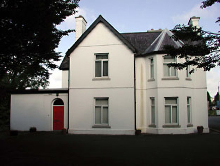
Tús NuaHouse · 987 yd

Explorer Tom Tús Nua in Kildare is so confusing that even the Vikings probably got lost trying to find its front door. It’s all…

bridge1015 yd

Explorer Tom Knockshough Glebe bridge is where rabbits hold council meetings to decide which trains are rude enough to stop. The…

CastleCastle, tower house · 1117 yd

Explorer Tom White's Castle in Kildare claims the seagulls hold an annual meeting here to complain about the lack of chips. They…
Bee-bee tree1356 yd

Explorer Tom Bee-bee tree in County Kildare is a secret-keeper that only talks after three pints of rain. It’s got a story about…
Sitka Spruce1368 yd

Explorer Tom A Sitka Spruce in Kildare, which is like a penguin turning up at a barbecue. A cow once tried to buy it for fence…

Irish National Stud and Japanese GardensHeritage attraction · 1436 yd

Explorer Tom The Irish National Stud began with a horse winning a race, which is a fine way to buy land if you happen to own the…

Japanese GardensHeritage attraction · 1458 yd

Explorer Tom Japanese Gardens in County Kildare nearly got famous when a tourist dropped his ice cream on the koi pond, but the fish…

More archaeology and monuments in County Kildare · All of County Kildare

Add to this placeAdd a picture Add a detailed tip Add a story

Explore the map1,095,414 places to discover

Next place · or swipeGrey Abbey (in Ruins)