
What is recorded here
From the National Monuments Service (Archaeological Survey of Ireland) record DG046-034
Places near here
Photo credits
- Maker not stated on source page, www.britainexpress.com
- Maker not stated on source page, commons.wikimedia.org
- Andreas F. Borchert, Wikimedia Commons · CC BY-SA 4.0
- National Inventory of Architectural Heritage
- Kenneth Allen, Geograph · CC BY-SA 2.0
- Eeno11, Wikimedia Commons · CC BY-SA 3.0
- Sitomon, Wikimedia Commons · CC BY-SA 2.0
- Maker not stated on source page, br.pinterest.com
 Standing stone in CarrowcashelStanding stone · 158 yd
Explorer Tom Standing stone in Carrowcashel sat on level arable land close to the shore of Lough Swilly, but now there is no trace…
 Killydonnell Friary GraveyardGraveyard · 193 yd
Explorer Tom Killydonnell Friary Graveyard shares the map with ruins of a friary founded in 1471 for the Franciscan Third Order. The…
 Killydonnell FriaryReligious house, Franciscan Third Order Regular · 198 yd
Explorer Tom Killydonnell Friary was founded in 1471 by Calvagh O'Donnell, yet the Stewart family later turned its sacristy into a…
 Ardrumman HouseCountry house · 1313 yd
Explorer Tom Ardrumman House hosted a dance that went so far the chimney pots are still trying to catch their breath, especially…
 Kilcreen National SchoolSchool · 1500 yd
Explorer Tom Kilcreen National School's 1936 porch gave boys and girls separate doors. If I forgot which one was mine after the…
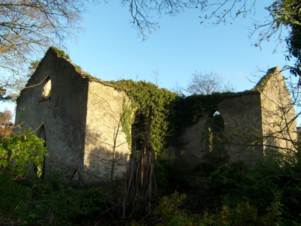 Kilcreen Catholic ChapelChurch/chapel · 1596 yd
Explorer Tom Kilcreen Catholic Chapel was built around 1820. The survey records its roofless T-shaped walls, pointed arches and a…
 Fort StewartFarmyard complex · 1694 yd
Explorer Tom Fort Stewart has a farmyard from around 1780 with two yards and several long blocks behind the house. I thought running…
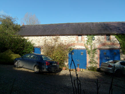 ShellfieldFarmyard complex · 1.2 mi
Explorer Tom Shellfield smells like old stone and regret, according to Tom, which is a very specific scent profile for a farmyard…
 Standing stone in FortstewartStanding stone · 2.1 mi
Explorer Tom Standing stone in Fortstewart has completely vanished from the maps! The record says there’s no trace left at all…
 Rowan2.2 mi
Explorer Tom Rowan is in the middle of a fierce feud with the oak next door over who has the better view of the sunset. They’ve been…
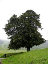 European Yew2.2 mi
Explorer Tom European Yew in County Donegal is a yew, which means it’s tough, old, and probably poisonous if you look at it wrong.…
 Mapped graveyardGraveyard · 2.3 mi
Explorer Tom This mapped graveyard had a fox take charge for a whole week before anyone noticed, and now the locals treat him like…
More archaeology and monuments in County Donegal · All of County Donegal

What do you know about this place?Tap to add a comment or ask a question