What is recorded here
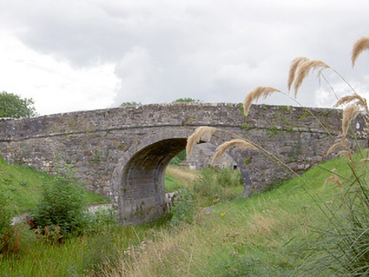
Foygh Bridge has a water pipe sticking out of its side above the Royal Canal. It looks like somebody ordered a garden tap, left the plumber unsupervised, and came home to find he’d connected Dublin.
Single-arch humpbacked canal bridge carrying road over Royal Canal, built c. 1815. Round/elliptical-headed arch with dressed ashlar limestone voussoirs and dressed ashlar limestone masonry to barrel. Rubble stone construction to spandrel walls, formerly rendered, with cut limestone string course at road/deck level.…
Read the whole record
Single-arch humpbacked canal bridge carrying road over Royal Canal, built c. 1815. Round/elliptical-headed arch with dressed ashlar limestone voussoirs and dressed ashlar limestone masonry to barrel. Rubble stone construction to spandrel walls, formerly rendered, with cut limestone string course at road/deck level. Rubble stone construction to parapets, formerly rendered, with curving ends terminated in dressed ashlar limestone piers (on square-plan). Water pipe to east elevation of bridge. Dressed limestone coping over parapet walls. Towpath to south bank of canal, going under bridge, with dressed limestone retaining walls to canal banks (north and south). Located to the south of Keenagh.
A typically well-built canal bridge, which is a valuable part of the extensive canal-related built and industrial heritage of County Longford. Although humble in form, this structure has a simple and functional elegance. It is robustly built in good-quality stone masonry, which is testament to the long-term ambitions of the Royal Canal Company at the start of the nineteenth century. It was probably built to designs by John Killaly (1766 – 1832), the engineer responsible for the construction of the Royal Canal between Coolnahay to Cloondara, which started in 1814 and was completed in 1817 (28 years after the canal work was started in Dublin. The main contractors involved were Henry, Mullins and McMahon. Although the canal is currently disused, the towpath provides a recreational amenity and this bridge affords interesting views to the pedestrian as well as being a notable feature and landmark in the landscape. Visible from the nearby road, it brings architectural and historical interest to the Foygh area to the south of Keenagh.
From the Buildings of Ireland (National Inventory of Architectural Heritage) record 13402212
Places near here
Photo credits
- National Inventory of Architectural Heritage
- Sheila1988, Wikimedia Commons · CC BY-SA 4.0
- David Baird, Geograph · CC BY-SA 2.0
- Mike Searle, Geograph · CC BY-SA 2.0
- Sailko, Wikimedia Commons · CC BY 3.0
- David Baird, Wikimedia Commons · CC BY-SA 2.0
- Arno-nl, Wikimedia Commons · CC BY-SA 4.0
- Christopher Hilton, Wikimedia Commons · CC BY-SA 2.0
- Kieran Campbell, Geograph · CC BY-SA 2.0
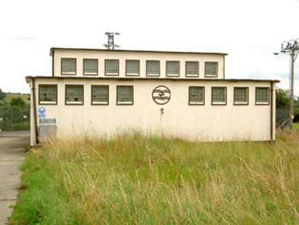 Ballymahon SubstationElectricity substation · 647 yd
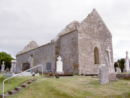 church/chapel977 yd
 Corlea Bog Walk Canal BranchWalking route · 1.5 mi
 Corlea Trackway Interpretative CentreHeritage attraction · 1.7 mi
 Leveret IslandIslet · 4.8 mi
 Bawn in CastlereaBawn · 4.9 mi
 Ecclesiastical enclosure in InchbofinEcclesiastical enclosure · 5.5 mi
 InchbofinIslet · 5.7 mi
 Safe HarbourBay · 8.0 mi
 RindoonWood · 8.0 mi
 Rindown CastleCastle, Anglo-Norman masonry castle · 8.1 mi
 Historic town in Warren,rinnaganHistoric town · 8.1 mi
More historic places in County Longford · All of County Longford
What do you know about this place?Tap to add a comment or ask a question