What is recorded here
'Dooanmore' is a small island just 7m off the main land at its nearest point. Most of the island is made up of rock outcrop but along the W side of the island is a level sheltered strip c. 120m N-S × 15m to 25m wide. An earthen bank up to 1m high and 3m wide runs along the cliff edge of the strip up to the rock…
Read the whole record
From the National Monuments Service (Archaeological Survey of Ireland) record DG018-001
Places near here
Photo credits
- National Inventory of Architectural Heritage
- Ronnie Nijboer, Wikimedia Commons · CC0
- MPF, Wikimedia Commons · CC BY-SA 3.0
- Maker not stated on source page, www.pinterest.com
- Dympna McAteer, Wikimedia Commons
- Golfing in Ireland; photographer not stated, Source publisher
- Maker not stated on source page, commons.wikimedia.org
- Kenneth Allen, Geograph · CC BY-SA 2.0
- Maker not stated on source page, www.rte.ie
- N Chadwick, Geograph · CC BY-SA 2.0
- Maker not stated on source page, ru.dreamstime.com
 Carrablagh HouseCountry house · 344 yd
Explorer Tom Carrablagh House was built around 1850 as a seven-bay, U-shaped country house overlooking Lough Swilly. The inventory…
 Wych Elm428 yd
Explorer Tom Wych Elm in Donegal is the site of a fierce fairy dispute over parking rights, as they argue about who gets the best…
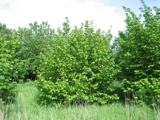 Hazel1587 yd
Explorer Tom Hazel in County Donegal has a long list of former names because every farmer who passed by thought they could do a…
 St Columkille's Pilgrim CairnCairn, unclassified · 1591 yd
Explorer Tom St Columkille's Pilgrim Cairn is a massive stack of stones left by pilgrims who came to pray at the nearby well. It’s…
 Drumnacraig BeachBeach / strand · 1.3 mi
Explorer Tom Drumnacraig Beach is a tucked-away piece of Fanad coast with a grand neighbour: the cliffs and Great Pollet Sea Arch…
 Portsalon Golf ClubGolf course · 1.5 mi
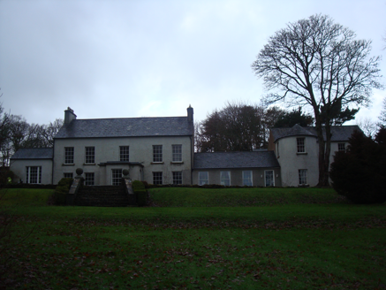 GreenfortCountry house · 1.7 mi
Explorer Tom Greenfort hides a little temple in its private gardens. I picture someone walking past it every morning, wondering if…
 Killavee Burial GroundBurial ground · 1.8 mi
Explorer Tom Killavee Burial Ground is buried under heavy overgrowth on the edge of the sand hills behind Stocker Strand. Davies saw…
 PortsalonOfficial bathing water · 1.8 mi
Explorer Tom Portsalon has a beach so gracefully curved that it looks as if Lough Swilly used a compass and then showed off.…
 Páirc Uí Shiadhail, Fanad Gaels GAAGAA ground · 2.0 mi
 Dunree CentreMuseum · 2.5 mi
Explorer Tom Dunree Centre is one building in the Fort Dunree grounds, where the fort's story takes six exhibition chapters to tell.…
 Mapped graveyardGraveyard · 3.8 mi
Explorer Tom Another Mapped graveyard in County Donegal for us! If this place won the lotto, I bet it would buy a very fancy new…
More archaeology and monuments in County Donegal · All of County Donegal

What do you know about this place?Tap to add a comment or ask a question