What is recorded here
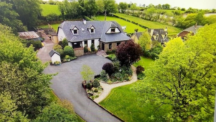
Two-storey gable-ended house to SE of road. NW elevation (roadside) of 5 bays, central rectangular door ope, modern windows and doors. SE elevation has irregular fenestration, small 1st floor windows just under eaves linked by brick string course. Photograph (Grove White 1905-25, vol. 3, opp. 320) shows house with thatched roof; thatch replaced with slate in 1954/55; chimneys on gables, projecting chimney on SW. Lower 2-storey addition to SW. Farm buildings to S. According to owner, built as dower house for Clogheen House (14878) probably in 1784 (ibid., 320). House shares piered entrance sweep with Kilmacoom House (built in 1911) c. 300m to ESE; carved stone lion atop pier, one of pair, 2nd on entrance to nearby Hazelwood.
The above description is derived from the published 'Archaeological Inventory of County Cork. Volume 4: North Cork' (Dublin: Stationery Office, 2000). In certain instances the entries have been revised and updated in the light of recent research.
Date of upload/revision: 14 January 2009
The monument record does not grant public access. Check the route and ask the landowner before entering private land.
- What survives
- Recorded monument
Places near here
 Enclosure in Clogheen (fermoy By.)Enclosure · 198 yd
 Kilmacoomhouse · 335 yd
 Enclosure in Ballybrack (fermoy By.)Enclosure · 966 yd
 Caherduggan Castle (Site of)Castle, unclassified · 980 yd
 IndicatedQuarry · 1080 yd
 CastleCastle, unclassified · 1.5 mi
 Scots PineScots Pine · 1.6 mi
 Doneraile HouseHeritage attraction · 1.8 mi
 European YewEuropean Yew · 1.8 mi
 Smith's WellSpring · 2.0 mi
 Lover' LeapCliff · 4.6 mi
 Lover's LeapCliff · 4.7 mi
Other information
Photo: Credit not shown in the picture search · Rights wording not checked; contact us if this picture should be removed