
Places near here
Photo credits
- National Inventory of Architectural Heritage
- Alexander Redfern, Wikimedia Commons · CC BY-SA 4.0
- Mike Searle, Wikimedia Commons · CC BY-SA 2.0
- Rasbak, Wikimedia Commons · CC BY-SA 3.0
- Paul Evans from London, United Kingdom, Wikimedia Commons · CC BY 2.0
- Colin Park, Geograph · CC BY-SA 2.0
- Hywel Williams, Geograph · CC BY-SA 2.0
- A.-K. D., Wikimedia Commons · CC BY-SA 4.0
 Corrabella HouseHouse · 1131 yd
Explorer Tom Corrabella House in Corrabella seems to have ended up in the wrong postcode because it’s covered in slate like a very fancy fish. The windows are unevenly spaced, which makes me think the builder lost count halfway through and just guessed at the rest. It’s got that T-plan shape that looks like it’s trying to catch the wind for fun.
 Tar BridgeBridge · 1.1 mi
Explorer Tom Tar Bridge in Curraheen is humping its way over the river like it’s trying to impress its rival next door. I’m convinced a king once crossed here and immediately regretted it because his horse refused to look up at those tall arches. Keep your distance from the parapet walls unless you fancy a tumble.
 Liam Lynch MonumentMonument · 2.8 mi
Explorer Tom The Liam Lynch Monument is still counting exactly how many cups of tea it took to build this thing in the first place. Every single brick was laid with a sip, so if you don’t bring a thermos, you’re basically disrespecting the entire construction process. Bring a flask and pretend you own the place.
 Ballindoney Castle (in ruins)Castle, tower house · 3.2 mi
Explorer Tom Ballindoney Castle has a fifth-storey room that looks like it’s trying to escape gravity, which is very cheeky for a stone building. A priest once lost a bet there over who could spot the sheep first. Bring your nan, she'll know more than me.
 Castle, Kilmanahan CastleCastle, tower house · 3.4 mi
Explorer Tom Castle, Kilmanahan Castle would survive a zombie attack by hiding in its own foundations and hoping they’re too busy eating each other. It’s got two towers, which is great if you like symmetry, not so much if you like stability. Tell your mates you found it first.
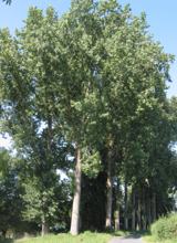 Hybrid Black Poplar3.6 mi
Explorer Tom Hybrid Black Poplar in County Tipperary is having a massive feud with the next village over because they stole one of its acorns last autumn. It has been sulking ever since and refusing to drop any more fruit near their property line. Pick a stone, any stone, and invent its biography.
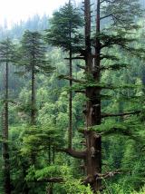 Deodar Cedar3.9 mi
Explorer Tom Deodar Cedar in County Tipperary keeps getting picked on by the wind because its pointy top looks exactly like a giant finger pointing at the sky in accusation. It stands there looking sharp and serious, while the breeze just whistles past it as if to say 'try again.' Get there early and have it all to yourself.
 KnockmealMountain / peak · 4.4 mi
Explorer Tom Knockmeal inspired a bad poem about its height that rhymed with 'cheese' and 'please'. The poet was drunk on the mountain air and his own mistakes. It's still trying to shake off that literary embarrassment today. Bring a coin for luck and keep it in your pocket.
 The VeeViewpoint · 4.5 mi
Explorer Tom The Vee thinks the road leading to it is a bit of a wimp for being so straight and predictable all the time. It prefers to sit up here and judge everyone who drives too fast or takes selfies that don’t quite capture its majestic angle. Bring your nan along if you can, because she will absolutely know more about this hill than I ever will.
 KnocknagnauvMountain / peak · 4.6 mi
Explorer Tom Knocknagnauv does a secret dance when nobody is looking, shaking its stones to make sure they are still in order. It’s very particular about its appearance and spends hours arranging its rocks into patterns that only it can see. Go at sunset and thank me later.
 Crusader's GraveHeritage attraction · 5.8 mi
Explorer Tom Crusader's Grave is technically from the 1600s, so the crusading thing was a bit of a stretch. I bet it’s full of smuggled whiskey rather than holy relics. Take a breath of that air, it's older than your car.
 Patricks WellHoly well · 6.1 mi
Explorer Tom Patricks Well in Patrickswell is sitting right next to a church, probably judging everyone who walks past without a proper hat. I wonder what the rabbits think of it? They’re definitely using it as a shortcut to the other side of the field. It’s famous for curing sore lips and eyes, which sounds like exactly what you need after a long day in the sun. A good place to forget your phone for ten
More archaeology and monuments in County Tipperary · All of County Tipperary

What do you know about this place?Tap to add a comment or ask a question