What is recorded here
In pasture. Noted by Went (1946, 144) 'a field locally known as the 'Palleashes',...the site of a curing station for pilchards operated by the "Spaniards" '. According to local information, foundations of houses uncovered during ploughing. No visible surface trace.
From the National Monuments Service (Archaeological Survey of Ireland) record CO140-046002
The monument record does not grant public access. Check the route and ask the landowner before entering private land.
- What survives
- Recorded monument
Places near here
Photo credits
- Garry Dickinson, Wikimedia Commons · CC BY-SA 2.0
- National Inventory of Architectural Heritage
- Martin Southwood, Geograph · CC BY-SA 2.0
- Podstawko, Wikimedia Commons · CC BY 4.0
Holy Well110 ydMining complex in BallycummiskMining complex · 336 yd Rossbrin CastleCastle · 600 ydbridge1.5 miGreenmount HouseHouse · 1.6 miCastle (in Ruins)Castle, tower house · 1.8 miCuas an BháidBay · 2.0 miTraighín na mBóBeach / strand · 2.0 miAn CuaisínBay · 2.0 miSkeam WestIslet · 2.0 miThe South StrandBeach / strand · 2.1 miSkeam EastIslet · 2.1 mi
 Rossbrin CastleCastle · 600 yd
 bridge1.5 mi
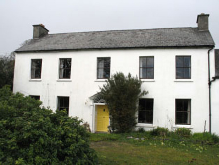 Greenmount HouseHouse · 1.6 mi
 Castle (in Ruins)Castle, tower house · 1.8 miCuas an BháidBay · 2.0 miTraighín na mBóBeach / strand · 2.0 miAn CuaisínBay · 2.0 mi
 Skeam WestIslet · 2.0 miThe South StrandBeach / strand · 2.1 mi
 Skeam EastIslet · 2.1 mi
More archaeology and monuments in County Cork · All of County Cork
What do you know about this place?