
What is recorded here
On the N-facing slope of Crocmore hill at the W end of Inishbofin in an area completely denuded of its bog and scraw cover. An extensive series of small roughly rectangular fields extend over an area c. 650m NW-SE by c. 250m NNE-SSW, with one larger subrectangular field at the SE end of the system. Only the…
Read the whole record
From the National Monuments Service (Archaeological Survey of Ireland) record GA009D026
Places near here
Photo credits
- Maker not stated on source page, www.visitgalway.ie
- -- منش , Wikimedia Commons · Public domain
- Maker not stated on source page, www.pinterest.com
- Photographer not named; image credited to Guinness by IrishCentral, www.irishcentral.com
- Maker not stated on source page, www.atlasobscura.com
- Pampuco, Wikimedia Commons · CC BY-SA 4.0
- Espresso Addict, Geograph · CC BY-SA 2.0
- National Inventory of Architectural Heritage
- Patrice78500, Wikimedia Commons · Public domain
- Jonathan Wilkins, Geograph · CC BY-SA 2.0
 Holy well in WestquarterHoly well · 1413 yd
Explorer Tom Holy well in Westquarter is now dry and stopped with turf, basically a retired athlete who just wants a nap. It sits in…
 InishbofinIsland · 1.3 mi
Explorer Tom I asked where the white cow went and was told to bring my own imagination. Inishbofin means Island of the White Cow…
 Graveyard in InishsharkGraveyard · 1.3 mi
Explorer Tom Graveyard in Inishshark has a family tree mostly made up of saints and one confused baker. They all seem to have…
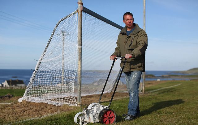 Fawnmore, Inis BofinGAA ground · 1.3 mi
 Cross-inscribed stone in InishsharkCross-inscribed stone · 1.5 mi
Explorer Tom Cross-inscribed stone in Inishshark sits opposite the clochan entrance, looking like it’s waiting for you to apologize…
 InishsharkIsland · 1.6 mi
Explorer Tom Inishshark is a small Galway island with a very big silence, and I will keep the jokes away from the people who had to…
 Port IslandIslet · 1.7 mi
Explorer Tom Port Island guards Bofin Harbour like a grumpy old doorman. It listens to every secret whispered by sailors since…
 Cleggan Old GraveyardCemetery · 6.6 mi
Explorer Tom Cleggan Old Graveyard claims it’s older than the hills around it, which is a bold and possibly exaggerated claim to…
 The RectoryRectory/glebe/vicarage/curate's house · 6.7 mi
Explorer Tom The Rectory in Emlagh (Ballynahinch By) saw a priest once try to juggle three cats on the porch. The whole thing ended…
 Iorras BeagMountain / peak · 20 mi
Explorer Tom Iorras Beag rises above Roundstone in County Galway with the swagger of a giant, despite being a fairly modest hill. It…
 Letterdife HouseOfficially recorded historic building · 20 mi
Explorer Tom Letterdife House in Letterdife is so irregularly planned that even the Vikings got lost trying to find it, blaming…
 Trá Chuan an MhadaBeach / strand · 20 mi
Explorer Tom Trá Chuan an Mhada has very strong opinions on modern buildings and thinks they all look like they were designed by a…
More archaeology and monuments in County Galway · All of County Galway

What do you know about this place?Tap to add a comment or ask a question