
What is recorded here
From the National Monuments Service (Archaeological Survey of Ireland) record LE027-054005
Places near here
Photo credits
- National Inventory of Architectural Heritage
- Suse, Geograph · CC BY-SA 2.0
- John M, Geograph · CC BY-SA 2.0
- Grose, Francis, 1731?-1791; Ledwich, Edward, 1738-1823, continuator, Wikimedia Commons · Public domain
Explorer Tom A hilltop enclosure in Sheemore would survive a zombie attack by just standing still and letting them get confused by its size. It encloses cairns and sits on the summit plateau, overlain by field systems that make it look messy. Get there early and have it all to yourself before the crowds.
Leabaidh DermotCave · 511 ydSheemore Ambush MemorialMonument · 534 yd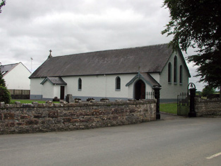 Saint Joseph's Catholic ChurchChurch/chapel · 1.9 mi
Explorer Tom Saint Joseph's Catholic Church in Tullylannan is being criticized by local seagulls for not having better stained glass designs. It’s set back nicely, enjoying its quiet little corner of judgment. Take a breath of that air.
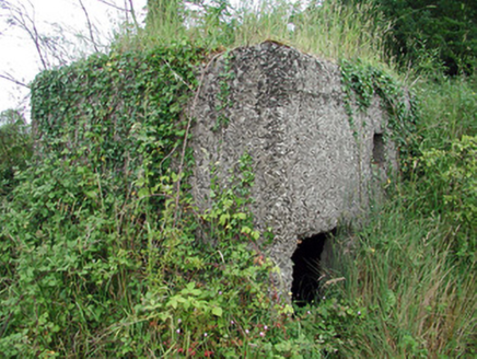 pill box2.0 mi
Explorer Tom Pill box in Tullylannan nearly got famous when a tourist mistook it for a giant concrete egg. It’s a WWII relic that hasn't fired a shot since before my grandpa was born. Stand back, squint, and it looks exactly like a very angry stone loaf.
 Shannon-Erne WaterwayVisitor information · 2.0 miSit of Breifny CastleCastle, tower house · 2.0 mi
 Finn McCool's MonumentArchaeological place · 2.6 miInishnagonIsland · 3.0 miRusheen IslandIslet · 3.4 mi
 Castle JohnCastle · 3.4 miDeclaration of IndependenceMemorial · 4.5 mi
More archaeology and monuments in County Leitrim · All of County Leitrim

What do you know about this place?Tap to add a comment or ask a question