
What is recorded here
On a plateau of rock outcrop. An area of about 24 acres (c. 10 ha) has relict field banks or walls. Two oval grass-covered fields (dims 44m E-W x 28m N-S; c. 60m E-W; c. 30m N-S) defined by grass-covered stone spreads (Wth 1-2m; H 0.2m) with other curvilinear walls extending out to the NW where one terminates at…
Read the whole record
From the National Monuments Service (Archaeological Survey of Ireland) record RO028-233002
Places near here
Photo credits
- Maker not stated on source page, www.thecollector.com
- Maker not stated on source page, www.wikidata.org
- Maker not stated on source page, www.pinterest.com
- Tulsk GAA club website; individual photographer not stated, www.tulskgaa.ie
- Willow, Wikimedia Commons · CC BY 2.5
- Gillaween, Wikimedia Commons · CC BY-SA 4.0
- Sawyer777, Wikimedia Commons · CC BY-SA 4.0
- Maker not stated on source page, www.irishamerica.com
- National Inventory of Architectural Heritage
- Maker not stated on source page, www.visitgalway.ie
- Mike Searle, Wikimedia Commons · CC BY-SA 2.0
- Maker not stated on source page, www.gaa.ie
 Passage tomb in SheegeeraghPassage tomb · 172 yd
Explorer Tom The Passage Tomb in Sheegeeragh has a passage so tight you'd need to apologize to enter. It’s got two lines of stones…
 Fairy fort / earthen ringfort in SheegeeraghFairy fort / earthen ringfort · 563 yd
Explorer Tom Fairy fort / earthen ringfort in Sheegeeragh is basically a grassy dome with two secret underground tunnels, which it…
 Church (in Ruins)Church · 1546 yd
Explorer Tom Church in Carns has a shortcut that isn't a shortcut, leading you through fields to nowhere in particular unless you…
 Tulsk Lord Edwards GAAGAA ground · 1.5 mi
 European ash2.4 mi
Explorer Tom European ash in County Roscommon has been the subject of some wild prophecies that never actually came true, which is…
 The Mórrígan: OweynagatLegend location · 4.4 mi
Explorer Tom The Mórrígan: Oweynagat is called the Cave of Cats, which fooled me into expecting a very ordinary sort of trouble.…
 Queen Medb: RathcroghanLegend location · 4.4 mi
Explorer Tom Queen Medb: Rathcroghan is where the Táin starts turning a quarrel about a bull into an epic. Medb had a royal seat…
 CastleCastle, unclassified · 9.2 mi
Explorer Tom Castle in Emlagh would tell its younger self to stop being so dramatic about crumbling. It’s just a pile of rocks…
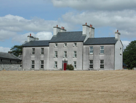 Dundermot HouseCountry house · 9.8 mi
Explorer Tom Dundermot House in Dundermot sits on a hill overlooking the River Suck, probably humming 'Country Roads' every single…
 Glinsk CastleVisitor attraction · 11 mi
Explorer Tom Glinsk Castle smells like a mix of old books, wet stone, and whatever the ghosts were having for dinner last night…
 Bawn in Glinsk (ballymoe By.)Bawn · 11 mi
Explorer Tom Bawn in Glinsk listens to what goes on inside the walls and probably hears the Burkes arguing about who left the light…
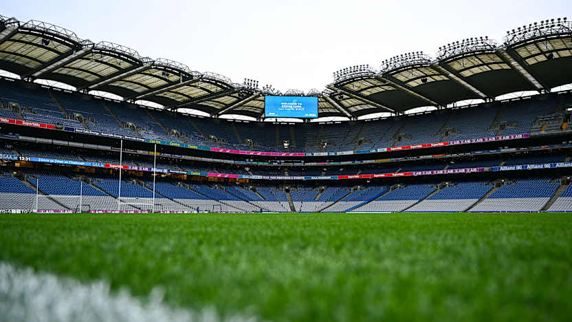 Fr. Stephen's Park, Clonberne/KilkerrinGAA ground · 22 mi
More archaeology and monuments in County Roscommon · All of County Roscommon

What do you know about this place?Tap to add a comment or ask a question