
What is recorded here
From the National Monuments Service (Archaeological Survey of Ireland) record GA086-213
Places near here
Photo credits
- Maker not stated on source page, www.flickr.com
- National Inventory of Architectural Heritage
- Maker not stated on source page, www.animalia-life.club
- Maker not stated on source page, ru.pinterest.com
- Photographer not named on Sarsfields GAA club page, www.sarsfields-gaa.com
- Maker not stated on source page, www.geograph.ie
- Maker not stated on source page, storage.googleapis.com
- Maker not stated on source page, www.dreamstime.com
- Maker not stated on source page, tr.pinterest.com
- Maker not stated on source page, www.pinterest.com
 Graveyard in Grange (kilconnell By.)Graveyard · 1.2 mi
Explorer Tom Graveyard in Grange is secretly proud of one very lumpy potato it grew last year. That vegetable had more character…
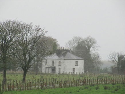 Rathglass HouseCountry house · 1.2 mi
Explorer Tom Rathglass House has so many chimney pots that it looks like it’s smoking a very thick, historic cigarette. It hears…
 CastleCastle, unclassified · 1.3 mi
Explorer Tom Castle in Rathglass is known as 'Raglas' to the locals, which sounds like a bad cough medicine. It’s not even located…
 Church (Site of)Church · 1.3 mi
Explorer Tom Church in Knockbrack is just a shallow depression and a hollow mound, which is a bit like describing a pizza as 'a…
 Sarsfields GAA, CastlebinGAA ground · 1.5 mi
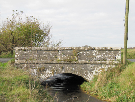 Carra BridgeBridge · 1.7 mi
Explorer Tom Carra Bridge is complaining to the council that its parapet walls are getting too subtle for modern traffic. It thinks…
 Enclosure in GortfaddaEnclosure · 2.0 mi
Explorer Tom Enclosure in Gortfadda is a bit of a mess, shaped like a kidney stone and hiding an oval mound that nobody can explain.…
 Fairy fort / ringfort in Tooreen (kilconnell By.)Fairy fort / ringfort · 2.0 mi
Explorer Tom Fairy fort / ringfort in Tooreen got quarried so badly it looks like a donut bitten by a very angry goat. If you go, do…
 Beech Hill BridgeBridge · 2.1 mi
Explorer Tom Beech Hill Bridge has a humped back and thinks that makes it strong enough to survive a zombie attack. The little…
 Fairy fort / ringfort in LisnamoltaunFairy fort / ringfort · 2.6 mi
Explorer Tom Fairy fort / ringfort in Lisnamoltaun is very poorly preserved and has been extensively quarried. It’s basically a…
 Fairy fort / earthen ringfort in LisnamoltaunFairy fort / earthen ringfort · 2.9 mi
Explorer Tom Fairy fort / earthen ringfort in Lisnamoltaun is a mystery because the details are scarce. I say it's hiding something…
 Fairy fort / ringfort in Killagh MoreFairy fort / ringfort · 3.1 mi
Explorer Tom Fairy fort / ringfort in Killagh More is proud of its underground passage, I bet. It’s got a causewayed entrance and a…
More archaeology and monuments in County Galway · All of County Galway

What do you know about this place?Tap to add a comment or ask a question