
What is recorded here
From the National Monuments Service (Archaeological Survey of Ireland) record KK028-059002
Places near here
Photo credits
- Maker not stated on source page, en.wikipedia.org
- A.-K. D., Wikimedia Commons · CC BY-SA 4.0
- National Inventory of Architectural Heritage
- Maker not stated on source page, www.flickr.com
- Maker not stated on source page, kilkennycoco.ie
- Andreas F. Borchert, Wikimedia Commons · CC BY-SA 4.0
- Algirdas at Lithuanian Wikipedia, Wikimedia Commons · Public domain
 Linear earthwork in Jerpoint WestLinear earthwork · 387 yd
Explorer Tom This Linear earthwork in Jerpoint West is having a serious feud with the rain because it keeps washing its memory away.…
 Holy WellSpring · 552 yd
Explorer Tom Holy Well got its location wrong on the map because the surveyor was three pints deep and thought the hill looked like…
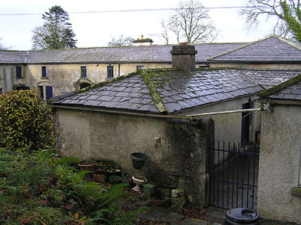 BelmoreOutbuilding · 573 yd
Explorer Tom Belmore outbuilding in Jerpointchurch is judged harshly by the local sheep for being too fancy. It has better dressings…
 Jerpoint HouseHouse · 598 yd
Explorer Tom Jerpoint House has had so many names it’s starting to forget what it actually is for a living. It’s dressed up in…
 Graveyard in JerpointchurchGraveyard · 650 yd
Explorer Tom Graveyard in Jerpointchurch hears everything through the old walls, including your mumbling from yesterday. It’s been…
 Church in JerpointchurchChurch · 652 yd
Explorer Tom Church in Jerpointchurch was built on a bargain where the stonemason got paid in bread and the priest got paid in…
 St. Nicholas's GraveyardGraveyard · 655 yd
Explorer Tom St. Nicholas's Graveyard has hidden messages in its stones, but they’re mostly just complaints about the weather from…
 St. Nicholas TombTomb, unclassified · 665 yd
Explorer Tom St. Nicholas Tomb in Jerpointchurch is not a shortcut. People try to use it as a path, but it’s really a tomb. St.…
Earthwork in JerpointchurchEarthwork · 702 ydExplorer Tom Earthwork in Jerpointchurch is playing hard to get, hiding from the Vikings who got hopelessly lost looking for it back…
 Abbey HouseMill (water) · 912 yd
Explorer Tom Abbey House in Jerpointabbey is a ruined mill that used to grind grain but now grinds your patience with its broken…
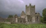 Jerpoint AbbeyHeritage attraction · 1046 yd
Explorer Tom Jerpoint Abbey had land stretching across roughly 14,000 acres before Henry VIII's officials brought its monastic life…
 Pedunculate Oak1.0 mi
Explorer Tom Pedunculate Oak in Kilkenny imagines a twin across the sea, probably wearing a silly hat. It’s just a big tree with a…
More archaeology and monuments in County Kilkenny · All of County Kilkenny

What do you know about this place?Tap to add a comment or ask a question