
What is recorded here
Situated in rough pasture on a ledge (Wth 60m) at the foot of a NW-facing cliff (H 7–8m) overlooking the Caher River and Fanore dunes. A field system of possibly prehistoric or medieval date defined by low often collapsed sections of stone walling which are overgrown with thorn and briars. The field system covers an…
Read the whole record
From the National Monuments Service (Archaeological Survey of Ireland) record CL001-013006
Places near here
Photo credits
- National Inventory of Architectural Heritage
- Maker not stated on source page, www.tripadvisor.ie
- Gordon Hatton, Geograph · CC BY-SA 2.0
- Maker not stated on source page, www.tripadvisor.com
- Maker not stated on source page, storage.googleapis.com
- Maker not stated on source page, en.m.wikipedia.org
- Danny Burke, Wikimedia Commons · CC BY-SA 2.5
- Maker not stated on source page, www.gettyimages.com
- Maker not stated on source page, www.galwaytourism.ie
- Suzanne Mischyshyn, Geograph · CC BY-SA 2.0
- The original uploader was Rwxrwxrwx at English Wikipedia ., Wikimedia Commons · CC BY-SA 3.0
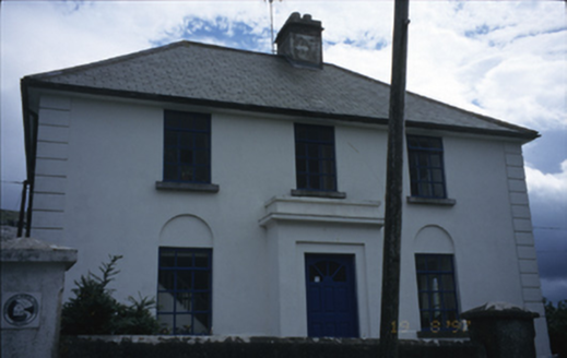 garda station/constabulary barracks213 yd
Explorer Tom Garda station in Fanore More is now a hostel, so the ghosts have to share a bathroom with backpackers. I bet a poet…
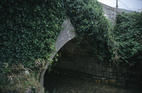 Fanore BridgeBridge · 300 yd
Explorer Tom Fanore Bridge in Fanore More spans the river like it owns the place, which it probably does. I bet there's a biscuit…
 Fanore Beach - Burren GeositeVisitor information · 1078 yd
Explorer Tom Fanore Beach - Burren Geosite is having a total identity crisis, posting selfies that are half sand and half ancient…
 Fanore BeachBeach / strand · 1162 yd
Explorer Tom Fanore Beach looks like somebody laid a bright sandy welcome mat at the edge of the Burren. The Caher River meets the…
 Caher Bridge GardenGarden · 1753 yd
Explorer Tom Caher Bridge Garden has very strong opinions on modern buildings, particularly those that use glass, which it describes…
 Fairy fort / stone ringfort in BallyellyFairy fort / stone ringfort · 1.5 mi
Explorer Tom Fairy fort / stone ringfort in Ballyelly is basically a subrectangular cashel where a goat once held court and demanded…
 Enclosure in BallyellyEnclosure · 1.6 mi
Explorer Tom Enclosure in Ballyelly is an oblong drystone-walled structure at the base of a rocky hill, with a prophecy about it…
 CaherdoonfergusFairy fort / stone ringfort · 1.8 mi
Explorer Tom Caherdoonfergus sits above Black Head like it owns the place, even if nobody knows who built it. Tell me if the fairy…
 Craggagh CemeteryCemetery · 1.9 mi
Explorer Tom Craggagh Cemetery in County Clare hosted a dance one night that went way too far, with the ghosts getting a bit rowdy…
 Lighthouse CaveCave · 2.2 mi
Explorer Tom Lighthouse Cave in Murrooghtoohy North has a prophecy about becoming the world's most famous cave, but it hasn't…
 Black HeadHeadland · 2.2 mi
Explorer Tom Black Head would bring a very heavy coat to any party because it thinks it’s always cold and slightly damp inside. It’s…
 AilladieCliff · 5.0 mi
Explorer Tom Ailladie is eight hundred metres of Clare limestone that makes climbers grin and makes me check where my feet are. The…
More archaeology and monuments in County Clare · All of County Clare

What do you know about this place?Tap to add a comment or ask a question