What is recorded here
OS aerial photographs (2005) show the extensive remains of a series of small fields with cultivation ridges enclosed by low earthen banks in an area of outcropping rock on the banks of the River Inny. These appear to be post-1700 AD in date. The large, irregularly-shaped platform which is visible on the aerial photographs is the remains of a natural hillock of outcropping rock. Possible remains of a sunken rectangular house (int. dims. 14m x 3m, D 0.4m) associated with field boundaries and cultivation ridges also appear to be post-1700 AD in date. However this sunken feature may just be the remains of an open-cast quarry as there are no definite wall-footings visible. This possible building along with small fields and a lime-kiln are indicated on the 1837 ed. of the OS 6-inch map and are probably of post-1700 AD date..
OS aerial photographs (2005) show the extensive remains of a series of small fields with cultivation ridges enclosed by low earthen banks in an area of outcropping rock on the banks of the River Inny. These appear to be post-1700 AD in date. The large, irregularly-shaped platform which is visible on the aerial photographs is the remains of a natural hillock of outcropping rock. Possible remains of a sunken…
From the National Monuments Service (Archaeological Survey of Ireland) record LF027-043
The monument record does not grant public access. Check the route and ask the landowner before entering private land.
- What survives
- Recorded monument
Places near here
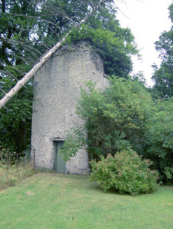 Clooncallow HouseFolly, building misc · 587 yd
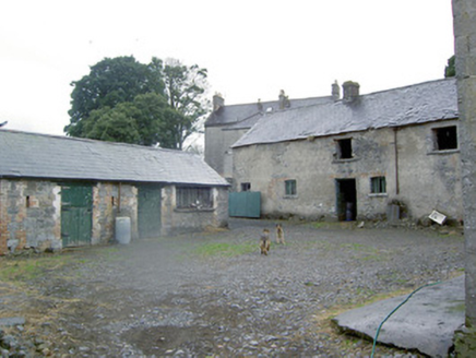 Clooncallow HouseOutbuilding · 599 ydBallymulvey HouseCastle, unclassified · 673 ydIndicatedEnclosure · 1252 ydTarget WoodWood · 1358 ydNewcastle WoodsForest · 1497 ydEnclosure in Cloonkeen (rathcline By.)Enclosure · 1544 ydGuest ServicesVisitor information · 1.4 miGoldsmith Birthplace, PallasVisitor information · 1.5 mi
 European Beech1.9 miCastleCastle, motte · 2.2 mi
 Corlea Trackway Interpretative CentreHeritage attraction · 5.6 mi
Pictures: National Inventory of Architectural Heritage; Malene Thyssen, Wikimedia Commons · CC BY-SA 3.0; Sheila1988, Wikimedia Commons · CC BY-SA 4.0
More archaeology and monuments in County Longford · All of County Longford
What do you know about this place?