
What is recorded here
Archaeological testing (04E1383) by A. Hayden on a large development site of about 8 hectares (c. 20 acres) uncovered evidence of furrows at its N limit, and more complex evidence of medieval fields at its SW edge (Hayden 2004). Further excavation under the same licence (Hayden 2005) recorded a NE-SW boundary ditch…
Read the whole record
From the National Monuments Service (Archaeological Survey of Ireland) record ME051-044
Places near here
Photo credits
- Maker not stated on source page, commons.wikimedia.org
- National Inventory of Architectural Heritage
- Harold Strong, Geograph · Creative Commons Attribution-ShareAlike 2.0
- Maker not stated on source page, au.pinterest.com
- Maker not stated on source page, www.pinterest.com
- Royalcanalrunner, Wikimedia Commons · CC BY-SA 4.0
- Harold Strong, Geograph · CC BY-SA 2.0
- Maker not stated on source page, www.tripadvisor.ca
 Linear earthwork in Clonee (dunboyne By.)Linear earthwork · 388 yd
Explorer Tom Linear earthwork in Clonee is sitting in the flood-plain of the Tolka River, looking like it’s waiting for the water to…
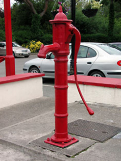 water pump438 yd
Explorer Tom Water pump in Clonee thinks it’s the main event because of its fancy fluting, but it’s just metal. It’s constantly…
 Clonee BridgeBridge · 482 yd
Explorer Tom Clonee Bridge over the Tolka took four hundred cups of tea to build, according to local legend. The limestone texture…
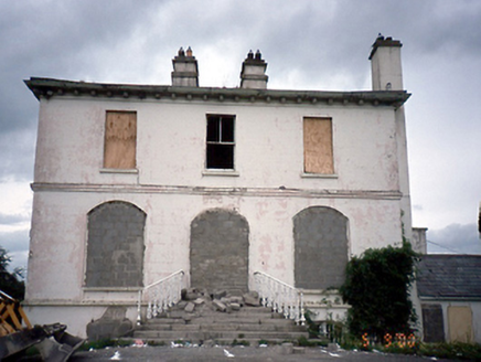 Phibblestown HouseHouse · 1097 yd
Explorer Tom Phibblestown House in Castaheany is shoring up its ground floor openings like it’s bracing for a very long, boring…
 Church in LoughsallaghChurch · 1156 yd
Explorer Tom Church in Loughsallagh is guarding a hidden treasure that is definitely just an old biscuit tin left behind by someone…
 Holy well in LoughsallaghHoly well · 1167 yd
Explorer Tom Loughsallagh’s well sits in a graveyard and handles nosey neighbours by simply ignoring them for two centuries. It’s a…
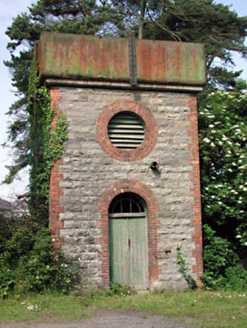 Dunboyne Railway StationWater tower · 1.0 mi
Explorer Tom Dunboyne Railway Station water tower is ordering double chips with extra vinegar. It stands tall on the old line…
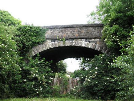 bridge1.0 mi
Explorer Tom Bridge in Castlefarm on Station Road would be the best-dressed guest at any wedding, minus the tie. The limestone…
 Barnhill BridgeBridge · 1.2 mi
Explorer Tom Barnhill Bridge has a long-standing grudge with the weather because it keeps getting soaked and nobody brings it an…
 Packenham BridgeBridge · 1.6 mi
Explorer Tom Packenham Bridge is a humpback limestone bridge over the Royal Canal from 1820 that swears it has an imaginary twin…
 Church, GraveyardChurch · 1.8 mi
Explorer Tom The Church in Clonsilla had a poet fall in the ditch nearby who wrote a sonnet about his muddy socks. It has stood on…
 St Mary's GraveyardGraveyard · 1.8 mi
Explorer Tom St Mary's Graveyard in County Dublin would win the lotto and immediately buy a very expensive pair of headphones so it…
More archaeology and monuments in County Meath · All of County Meath

What do you know about this place?Tap to add a comment or ask a question