
What is recorded here
In rough boggy pasture, on the N side of the valley of the Ferta River. This field system, which was identified and recorded by Harte (2002), covers an area measuring 1.2km E-W x 500m N-S. The surviving linear and curvilinear walls protrude above the surface of the bog and are generally in an overgrown and collapsed…
Read the whole record
From the National Monuments Service (Archaeological Survey of Ireland) record KE070-120
Places near here
Photo credits
- Maker not stated on source page, www.tripadvisor.ie
- Maker not stated on source page, uk.pinterest.com
- Maker not stated on source page, commons.wikimedia.org
- Maker not stated on source page, www.pinterest.com
- Maker not stated on source page, www.flickr.com
- Maker not stated on source page, www.irishexaminer.com
- Colin Park, Geograph · CC BY-SA 2.0
- Maker not stated on source page, www.maltatoday.com.mt
- Maker not stated on source page, www.dreamstime.com
- Maker not stated on source page, www.joinmychurch.com
 Wedge tomb in CaherlehillanWedge tomb · 218 yd
Explorer Tom Wedge tomb in Caherlehillan has a bird that refuses to leave because it thinks the tomb is its personal bedroom. It’s…
 Fairy fort / stone ringfort in CaherlehillanFairy fort / stone ringfort · 508 yd
Explorer Tom Caherlehillan claims to be older than the mountains themselves, which is probably a stretch but who’s counting? Most of…
 Graveyard in CaherlehillanGraveyard · 624 yd
Explorer Tom Graveyard in Caherlehillan thinks the road leading to it is rude for not having better potholes. It has eighteen graves…
 Fairy fort / earthen ringfort in CoulaghFairy fort / earthen ringfort · 1066 yd
Explorer Tom Fairy fort in Coulagh has had so many names over the centuries that it’s given up trying to remember its own identity.…
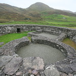 Fairy fort / stone ringfort in CahernamanFairy fort / stone ringfort · 1300 yd
Explorer Tom Fairy fort / stone ringfort in Cahernaman is like that uncle at the wedding who ate all the canapés and left only…
 Fairy fort / earthen ringfort in ToonFairy fort / earthen ringfort · 1729 yd
Explorer Tom Fairy fort / earthen ringfort in Toon has a New Year's resolution to stop being split by the road. It’s trying hard to…
 Been HillMountain / peak · 1.2 mi
Explorer Tom Been Hill is hiding a massive scandal about who actually built the little cairn on top, and it’s been keeping quiet for…
 Kells MountainMountain / peak · 3.2 mi
Explorer Tom Kells Mountain in Kerry would order extra large chips, mushy peas, and a pint of stout if it could get down to the…
 Srugreana AbbeyCountry house · 3.9 mi
Explorer Tom Srugreana Abbey is actually a Victorian house that lied about its religious upbringing for decades. A poet probably…
 IllaunnacartanIslet · 5.1 mi
Explorer Tom The map makers probably got Illaunnacartan wrong because they were drunk on porter and mistook a shadow for land. Now…
 Ballinakilla CemeteryCemetery · 5.2 mi
Explorer Tom Ballinakilla Cemetery in County Kerry was saved by a hero nobody remembers who once stopped a rogue cow from trampling…
 Church in KillogroneChurch · 6.7 mi
Explorer Tom Church in Killogrone in County Kerry is hiding a treasure that is definitely just an old biscuit tin. It’s sandwiched…
More archaeology and monuments in County Kerry · All of County Kerry

What do you know about this place?Tap to add a comment or ask a question