
What is recorded here
On a NW-facing slope overlooking seasonal floodland. Aerial reconnaissance in September 1984 (ASGAP 148:53-5) revealed a series of field boundaries extending over an area c. 600m NE-SW by c. 400m NW-SE. These are predominantly defined by low grassed-over stony banks. Though a number of subrectangular fields are visible at SW, the bulk of the remains form no coherent pattern. A number of rectangular house foundations were noted close to NW limits: possibly indicating an associated settlement cluster.
The above description is derived from the published 'Archaeological Inventory of County Galway Vol. II - North Galway'. Compiled by Olive Alcock, Kathy de hÓra and Paul Gosling (Dublin: Stationery Office, 1999).
Date of upload: 05 August 2010
The monument record does not grant public access. Check the route and ask the landowner before entering private land.
- What survives
- Recorded monument
Places near here
 Field system in CarheenardField system · 532 yd
 Mossfort Househouse · 888 yd
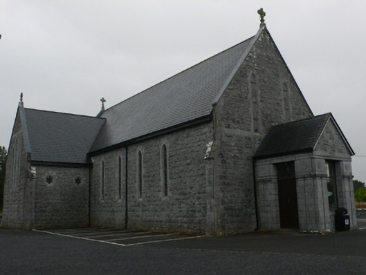 Catholic Church of Mary Immaculate and Saint Josephchurch/chapel · 1389 yd
 Enclosure in Beagh MoreEnclosure · 1489 yd
 Bawn in ArdrumkillaBawn · 1647 yd
 Castle Hacket (in ruins)Castle, hall-house · 1.7 mi
 KnockmaaWood · 2.3 mi
 Mass RockNamed rock · 3.2 mi
 Pesooge PlantationForest · 3.6 mi
 Kilcoona Round TowerHeritage attraction · 4.4 mi
 Walsh's IslandIslet · 7.4 mi
 Oileán an AoilIsland · 8.7 mi
Other information
Photo: Credit not shown in the picture search · Rights wording not checked; contact us if this picture should be removed