
What is recorded here
From the National Monuments Service (Archaeological Survey of Ireland) record LI022-228
Places near here
Photo credits
- National Inventory of Architectural Heritage
- Mike Searle, Geograph · CC BY-SA 2.0
- Garry Dickinson, Wikimedia Commons · CC BY-SA 2.0
- Willow, Wikimedia Commons · CC BY 2.5
- No machine-readable author provided. Christian1965~commonswiki assumed (based on copyright claims)., Wikimedia Commons · Public domain
- JohnArmagh, Wikimedia Commons · Public domain
Explorer Tom Enclosure in Fanningstown hosted a love story that ended badly because one party didn’t want to share the river view. It’s sitting in wet pasture, soaking up the drama and the rain with equal indifference and mild disappointment. Have a nosey, politely.
Enclosure in Boherload,carnaneEnclosure · 593 ydExplorer Tom Enclosure in Boherload, Carnane has strict rules: no phones, no hats, and definitely no questions asked. It’s a recorded monument that refuses to be seen on any map. Find a local and ask them the real story, then come back and tell me.
 Boherload HouseHouse · 871 yd
Explorer Tom Boherload House hums 'You Are My Sunshine' because its walled avenue needs cheering up. It’s a big farmhouse pretending to be something more mysterious and grand. Hum something sad nearby, it actually listens quite intently.
 Cloghane BridgeBridge · 1030 yd
Explorer Tom Cloghane Bridge in Boherload has set itself a New Year's resolution to stop arching so dramatically. It’s a single-arched masterpiece that looks like it’s mid-yawn every time you pass by. Bring a flask and pretend you own the place.
ToberauillinSpring · 1223 yd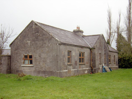 outbuilding, stables1670 ydCarnane RockNamed rock · 1674 yd
 Ballynagarde HouseCastle, tower house · 1.0 mi
 Lickadoon Castle (in ruins)Castle, tower house · 1.6 mi
 European ash4.5 mi
Explorer Tom European ash is thinking about what the builder was really thinking when they planted it here. It stands quietly in County Limerick, waiting for someone to notice its impressive height. Ideal for a moody photo you'll pretend wasn't posed.
 Áine and Gearóid Iarla: Lough GurLegend location · 5.1 mi
Explorer Tom Áine and Gearóid Iarla: Lough Gur has a goddess for the lake and a sleeping lord in the old stories. I thought I was coming to admire water and stones. Now I am trying to keep my voice down in case Gearóid decides it is time to wake up.
 Monasteranenagh AbbeyHeritage attraction · 5.4 mi
More archaeology and monuments in County Limerick · All of County Limerick

What do you know about this place?Tap to add a comment or ask a question