
Places near here
Photo credits
- Maker not stated on source page, www.irishtimes.com
- Maker not stated on source page, www.thejournal.ie
- National Inventory of Architectural Heritage
- Kieran Campbell, Geograph · CC BY-SA 2.0
- Arno-nl, Wikimedia Commons · CC BY-SA 4.0
- Christopher Hilton, Wikimedia Commons · CC BY-SA 2.0
- Maker not stated on source page, www.tripadvisor.ie
- Maker not stated on source page, www.visitgalway.ie
- Kmcnamee, Wikimedia Commons · CC BY-SA 4.0
- Gillaween, Wikimedia Commons · CC BY-SA 4.0
- Sawyer777, Wikimedia Commons · CC BY-SA 4.0
 Fairy fort / earthen ringfort in BallybroganFairy fort / earthen ringfort · 783 yd
Explorer Tom Fairy fort / earthen ringfort in Ballybrogan in County Roscommon is listening so hard through its thick walls that it…
 Enclosure in BinmuckEnclosure · 831 yd
Explorer Tom Binmuck’s enclosure once heard a prophecy that it would become a nightclub, but it settled for being a collapsed wall…
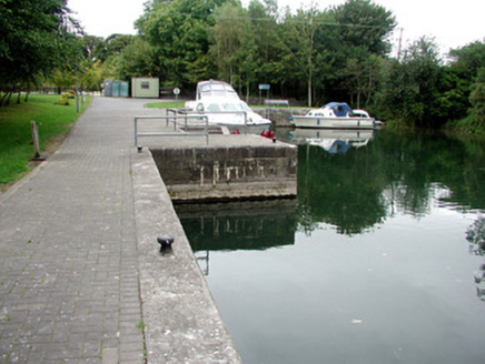 harbour/dock/port1749 yd
Explorer Tom Knockanyconor Harbour is sitting there by the Shannon, looking absolutely suspicious of anyone who isn’t a boat or a…
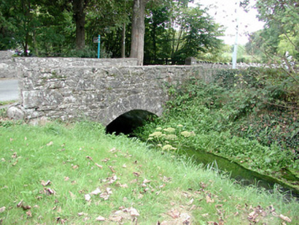 Historic buildingOfficially recorded historic building · 1.0 mi
Explorer Tom Historic building in Knockanyconor is basically a bridge that had a dance party with a mill stream and went way too…
 Rindown CastleCastle, Anglo-Norman masonry castle · 1.9 mi
Explorer Tom Rindown Castle would write 'looking for adventure' on its dating profile. It's got a bay nearby, so the views are…
 Safe HarbourBay · 1.9 mi
Explorer Tom Safe Harbour would post on social media with a filter that makes it look calm, but we all know it’s actually having a…
 RindoonWood · 2.0 mi
Explorer Tom Rindoon in County Roscommon has a hidden message carved into its stones that says 'I told you so' but nobody has…
 CastleCastle, unclassified · 5.5 mi
Explorer Tom Castle in Kilcar would describe itself as 'vintage' but honestly, it’s more like 'missing in action.' A map from 1636…
 Glinsk CastleVisitor attraction · 18 mi
Explorer Tom Glinsk Castle smells like a mix of old books, wet stone, and whatever the ghosts were having for dinner last night…
 Mountbellew - Moylough GAA pitchGAA ground · 20 mi
 The Mórrígan: OweynagatLegend location · 21 mi
Explorer Tom The Mórrígan: Oweynagat is called the Cave of Cats, which fooled me into expecting a very ordinary sort of trouble.…
 Queen Medb: RathcroghanLegend location · 21 mi
Explorer Tom Queen Medb: Rathcroghan is where the Táin starts turning a quarrel about a bull into an epic. Medb had a royal seat…
More archaeology and monuments in County Roscommon · All of County Roscommon

What do you know about this place?Tap to add a comment or ask a question