
What is recorded here
From the National Monuments Service (Archaeological Survey of Ireland) record RO015-074003
Places near here
Photo credits
- Maker not stated on source page, www.thejournal.ie
- Maker not stated on source page, en.wikipedia.org
- National Inventory of Architectural Heritage
- Maker not stated on source page, www.thecollector.com
- Maker not stated on source page, www.pinterest.ru
- Maker not stated on source page, commons.wikimedia.org
- Maker not stated on source page, www.lovefromscotland.co.uk
- Breda Durr / Roscommon Herald, www.roscommonherald.ie
 Bellanagare CastleCastle, unclassified · 438 yd
Explorer Tom Bellanagare Castle would post a selfie with the caption 'Ancient vibes only' and get ten likes. It was an O'Conor home…
 Church (Site of)Church · 657 yd
Explorer Tom Church in Ballaghcullia gave up its west wall for Lent, thinking penance would bring it back to life. It’s a tiny…
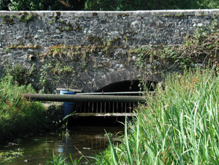 Bellanagare BridgeOfficially recorded historic building · 719 yd
Explorer Tom Bellanagare Bridge is the ultimate shortcut that isn't actually a shortcut, because every time you take it, you end up…
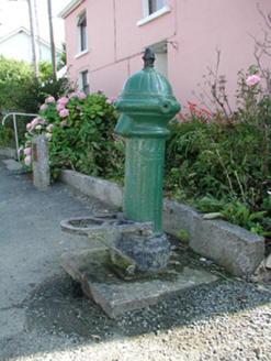 water pump801 yd
Explorer Tom The water pump in Bellanagare still works, which is impressive, considering it has had at least three different names…
 Ogham Stone1204 yd
Explorer Tom Ogham Stone in Drummin ended up in the wrong place because a cart driver tripped over a root. The name on it is blurry…
 Court tomb in Cornamucklagh and FalmoreCourt tomb · 1496 yd
Explorer Tom Court tomb in Cornamucklagh would bring its own trapezoidal shape to any party because it thinks it’s too unique for…
 Inscribed Stone1683 yd
Explorer Tom Inscribed Stone in Drummin is a headstone on a slope that might have had French writing on it, which is wild…
 Fairy fort / stone ringfort in Cornamucklagh and FalmoreFairy fort / stone ringfort · 1.0 mi
Explorer Tom Fairy fort in Cornamucklagh and Falmore keeps blaming the wind for stripping its walls down to nothing. The wind says…
 Standing stone in Tullaghan (castlereagh By.)Standing stone · 1.2 mi
Explorer Tom Standing stone in Tullaghan is leaning slightly northwest, probably because it’s tired of standing straight for…
 Earthwork in CloonshanvilleEarthwork · 1.6 mi
Explorer Tom Earthwork in Cloonshanville is a D-shaped feature that was truncated by a field bank on an old map. It’s not visible at…
 Nash Park, Frenchpark, Western Gaels GAAGAA ground · 2.3 mi
 Graveyard in Tully (castlereagh By.)Graveyard · 2.3 mi
Explorer Tom Graveyard in Tully is famous for being a children’s burial ground, which makes the whole vibe a bit too poignant for my…
More archaeology and monuments in County Roscommon · All of County Roscommon

What do you know about this place?Tap to add a comment or ask a question