
What is recorded here
From the National Monuments Service (Archaeological Survey of Ireland) record ME046-017
Places near here
Photo credits
- Robin Pollard, Wikimedia Commons · CC BY 3.0
- National Inventory of Architectural Heritage
- Maker not stated on source page, br.pinterest.com
- Maker not stated on source page, storage.googleapis.com
- Maker not stated on source page, en.wikipedia.org
- Maker not stated on source page, irisharchaeology.org
- Maker not stated on source page, www.pinterest.com
- Maker not stated on source page, www.europeanheritageawards.eu
- Mike Searle, Geograph · CC BY-SA 2.0
 AbbeyReligious house, Augustinian canons · 122 yd
Explorer Tom Abbey in Ballyboggan was built by a guy named Jordon Comin back in the 12th century. It sits right by the River Boyne…
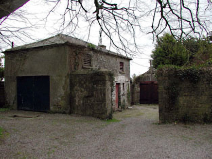 Harristown HouseFarmyard complex · 1.2 mi
Explorer Tom Harristown House is a whole complex of outbuildings acting like it’s a mini-estate with a cobbled courtyard and all.…
 Saint Brigid's Catholic ChurchChurch/chapel · 1.5 mi
Explorer Tom Saint Brigid's Catholic Church in Killinagh would order extra sauce at the chipper if it had hands. It’s all restrained…
 Site of Kilrathmurry GraveyardGraveyard · 1.6 mi
Explorer Tom Site of Kilrathmurry Graveyard is where a cow tried to buy the plot with a coin. No grave markers remain, just a low…
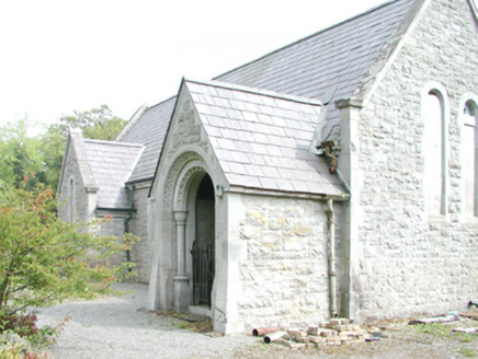 RahanChurch/chapel · 1.6 mi
Explorer Tom Rahan church bragged about surviving a storm that never happened. Orpen and Dickinson designed it to look tough, but I…
 Bullaun stone in KilrainyBullaun stone · 1.7 mi
Explorer Tom Bullaun stone in Kilrainy is playing hide-and-seek on that pasture slope. It’s so stubborn it’d survive a zombie attack…
 Ticroghan or Queen Marys CastleBastioned fort · 1.7 mi
Explorer Tom Ticroghan, or Queen Mary's Castle, loves a dramatic tune because it lost its manor. It’s got that 'I was important'…
 Fairy fort / earthen ringfort in Harristown (moyfenrath Upper By.)Fairy fort / earthen ringfort · 2.0 mi
Explorer Tom Fairy fort / earthen ringfort in Harristown made a New Year's resolution to finally find its entrance. It’s been trying…
 Glade WoodWood · 2.0 mi
Explorer Tom McGuinness's Wood holds a fake world record for having the most interesting patch of dirt, which was certified by a man…
 Croppies' GraveMemorial · 2.7 mi
Explorer Tom Croppies' Grave marks where rebels fell, and someone wrote a terrible poem about it that rhymed 'blood' with 'mud'. The…
 CastleHouse, fortified house · 3.0 mi
Explorer Tom Castle in Castlejordan was built over who owns the view, which is the only argument that makes sense to me. The…
 Castle JordanArchaeological place · 3.0 mi
Explorer Tom Castle Jordan has a curse that only affects people who don’t wave when they pass by. If you’re too cool for school…
More archaeology and monuments in County Meath · All of County Meath

What do you know about this place?Tap to add a comment or ask a question