DDiscover AloneMapAbout

Abbey in Ballyboggan

Religious house, Augustinian canons
Abbey in Ballyboggan
Photo: Robin Pollard, Wikimedia Commons · CC BY 3.0 · Report the wrong picture

The monument record does not grant public access. Check the route and ask the landowner before entering private land.

What do you know about this place?Tap to add a comment or ask a question

What you write will be public.

What is recorded here

Located towards the bottom of a SW-facing slope with a W-E section of the River Boyne c. 150m to the S. A priory following the rule of St Augustine and dedicated to the Holy Trinity, sometimes known as ‘de laude Dei’ – of the praise of God - was founded by a Jordon Comin in the late 12th century (Gwynn and Hadcock…

Read the whole record
Located towards the bottom of a SW-facing slope with a W-E section of the River Boyne c. 150m to the S. A priory following the rule of St Augustine and dedicated to the Holy Trinity, sometimes known as ‘de laude Dei’ – of the praise of God - was founded by a Jordon Comin in the late 12th century (Gwynn and Hadcock 1970, 159-60). In 1399 it was claimed that John O’Mayller, an Irishman, was prior, contrary to the statutes of Kilkenny, but Richard Cuthbert was able to demonstrate that he was the prior. The priory was burnt in 1446 and the following year the prior died of the plague. The priory possessed a much-venerated crucifix that was publically burnt in 1538 (Cogan 1862-70, 1, 169-170). At its suppression in 1540 the priory was described as a church that had long been the parish church, a cemetery, cloister, a hall and other chambers that were ‘decayed’. There were also a garden and an orchard in the precinct. Ninety two acres and a water-mill were held in demesne where seven cottiers provided very specific services. A hundred acres at Ballyboggan were held by Sir William Bermingham. The priory owned 50 acres at Herenston (Harristown) and 200 acres of pasture or arable at Knockeangwoll and Kylnodogaghe (Knockersally or Colehill), Kyllosyllyng (Killaskillen), Balloskystye (Ballynakill?) and the unknown Cardystown. They also owned 160 acres of woodland in these townlands, which together amounted to Ballyboggan parish. They held the churches of Castlejordan, Killaderry, Co. Offaly, and Kilbride, Co. Westmeath (White 1943, 311-13). The estate was granted to Sir William Bermingham, later made Lord Carbrey (Lewis 1837, 1, 123). The church consists of a nave (ext. dims 34.5m NE-SW; 10.2m NW-SE) and chancel (ext. dims 17m NE-SW; c. 10.2m NW-SE) but the transepts (dim. 8m NE-SW) are almost completely removed (total L 63m NE-SW). The SW wall of the nave is removed but the long walls have three windows each and there was a pointed doorway (Wth 2m) towards the W end of the NW wall. There were three windows in the NW and SE walls of the chancel, and the scar of a triple sedilia is in the NW wall, but Wilde (1850, 44-5) says they were trefoil, so the dressed stone was present then. Part of SW wall of the SE transept survives with pointed lancet windows in dressed sandstone. A raised rectangular platform (dims c. 30m NW-SE; c. 30m NE-SW) bounded partly by the SE transept and the nave may be the site of the cloister. The subrectangular graveyard (max. dims c. 55m NE-SW; c. 50m NE-SW) is located on the slope NE of the church. It is defined by masonry walls and has headstones dating from c. 1780 to the present. The church and graveyard are surrounded by the field system (ME046017----).

From the National Monuments Service (Archaeological Survey of Ireland) record ME046-018

Places near here

Photo credits
  • National Inventory of Architectural Heritage
  • Robin Pollard, Wikimedia Commons · CC BY 3.0
  • Maker not stated on source page, br.pinterest.com
  • Maker not stated on source page, storage.googleapis.com
  • Maker not stated on source page, en.wikipedia.org
  • Maker not stated on source page, irisharchaeology.org
  • Maker not stated on source page, www.pinterest.com
  • Kmcnamee, Wikimedia Commons · CC BY-SA 4.0
  • Maker not stated on source page, www.europeanheritageawards.eu
  • Mike Searle, Geograph · CC BY-SA 2.0
Harristown HouseFarmyard complex · 1.2 mi

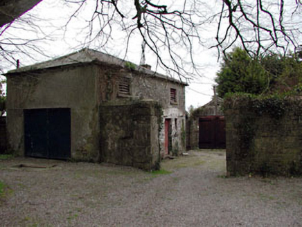
Explorer Tom Harristown House is a whole complex of outbuildings acting like it’s a mini-estate with a cobbled courtyard and all.…

Saint Brigid's Catholic ChurchChurch/chapel · 1.4 mi

Explorer Tom Saint Brigid's Catholic Church in Killinagh would order extra sauce at the chipper if it had hands. It’s all restrained…

Site of Kilrathmurry GraveyardGraveyard · 1.5 mi

Explorer Tom Site of Kilrathmurry Graveyard is where a cow tried to buy the plot with a coin. No grave markers remain, just a low…
RahanChurch/chapel · 1.6 mi

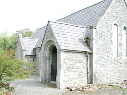
Explorer Tom Rahan church bragged about surviving a storm that never happened. Orpen and Dickinson designed it to look tough, but I…

Bullaun stone in KilrainyBullaun stone · 1.7 mi

Explorer Tom Bullaun stone in Kilrainy is playing hide-and-seek on that pasture slope. It’s so stubborn it’d survive a zombie attack…

Ticroghan or Queen Marys CastleBastioned fort · 1.8 mi

Explorer Tom Ticroghan, or Queen Mary's Castle, loves a dramatic tune because it lost its manor. It’s got that 'I was important'…

Fairy fort / earthen ringfort in Harristown (moyfenrath Upper By.)Fairy fort / earthen ringfort · 2.0 mi

Explorer Tom Fairy fort / earthen ringfort in Harristown made a New Year's resolution to finally find its entrance. It’s been trying…

Glade WoodWood · 2.0 mi

Explorer Tom McGuinness's Wood holds a fake world record for having the most interesting patch of dirt, which was certified by a man…

Balrinnet, BroadfordGAA ground · 2.4 miCroppies' GraveMemorial · 2.6 mi

Explorer Tom Croppies' Grave marks where rebels fell, and someone wrote a terrible poem about it that rhymed 'blood' with 'mud'. The…

CastleHouse, fortified house · 3.0 mi

Explorer Tom Castle in Castlejordan was built over who owns the view, which is the only argument that makes sense to me. The…

Castle JordanArchaeological place · 3.0 mi

Explorer Tom Castle Jordan has a curse that only affects people who don’t wave when they pass by. If you’re too cool for school…

More historic places in County Meath · All of County Meath

Add to this placeAdd a picture Add a detailed tip Add a story

Explore the map1,095,414 places to discover

Next place · or swipeHarristown House