
What is recorded here
From the National Monuments Service (Archaeological Survey of Ireland) record DG090-009003
Places near here
Photo credits
- Maker not stated on source page, www.pinterest.ca
- Maker not stated on source page, www.pinterest.com
- National Inventory of Architectural Heritage
- Maker not stated on source page, www.tuatha.ie
- Maker not stated on source page, en.wikipedia.org
- Maker not stated on source page, commons.wikimedia.org
- John M / Geograph, www.geograph.ie
- Maker not stated on source page, ostrovok.ru
 Portal tomb in Srath Bruithne UachtarachPortal tomb · 1180 yd
Explorer Tom Portal tomb in Srath Bruithne Uachtarach stands in a cairn on a mountain slope. The survey thought turf cutting may…
 Anomalous stone group in Srath Bruithne ÍochtarachAnomalous stone group · 1.1 mi
Explorer Tom Anomalous stone group in Srath Bruithne Íochtarach might be a stone circle, or natural rocks making a convincing trick.…
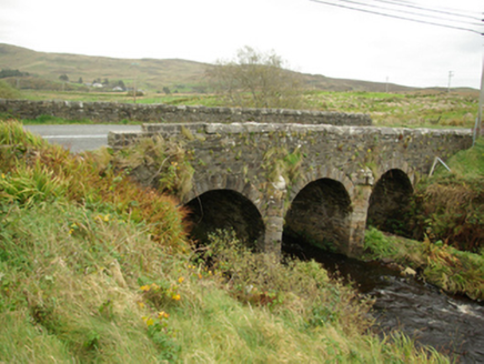 Droichead Caiseal CharnaBridge · 1.2 mi
Explorer Tom Droichead Caiseal Charna has three arches and pointed stone cutwaters on the Ballaghdoo River. Local accounts say the…
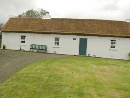 Teachín RyanHouse · 1.2 mi
Explorer Tom Teachín Ryan in Cill Chathasaigh wears a roof held down by ropes and stone pegs! Built around 1860, it looks like the…
 Droichead Cró na SaileachBridge · 1.3 mi
Explorer Tom Droichead Cró na Saileach has a round, rocky nose sticking out into the river. I bet it was built by masons who just…
 Stone circle in Srath Bruithne ÍochtarachStone circle · 1.3 mi
Explorer Tom Stone circle in Srath Bruithne Íochtarach was just sitting under the turf all this time! I imagine someone swinging a…
 Bun na nEasann BridgeBridge · 1.4 mi
Explorer Tom Bun na nEasann Bridge has a V-shaped cutwater on its central pier above a tributary of the Ballaghdoo River. A bridge…
 Cill Chartha Teach ParóistePresbytery/parochial/curate's house · 1.5 mi
Explorer Tom Cill Chartha Teach Paróiste has canted bay windows that look like they are squinting at the church down the road. I…
 Kilcar Old GraveyardGraveyard · 1.9 mi
Explorer Tom Kilcar Old Graveyard measures 28 by 44 metres around a church whose history refuses a neat straight line. A 1622…
 Kilkieran Burial GroundCemetery · 2.2 mi
Explorer Tom Kilkieran Burial Ground once predicted that a giant would land there in 1920, but he just kept missing the turn by a…
 Towney Park, KilcarGAA ground · 2.4 mi
 Blue Haven HotelHotel · 2.5 mi
Explorer Tom Blue Haven Hotel might be blue, but it’s definitely not the haven you need. I bet you find a hidden biscuit tin…
More archaeology and monuments in County Donegal · All of County Donegal

What do you know about this place?Tap to add a comment or ask a question