
What is recorded here
From the National Monuments Service (Archaeological Survey of Ireland) record KE101-120002
Places near here
Photo credits
- Nigel Cox, Geograph · CC BY-SA 2.0
- Maker not stated on source page, www.flickr.com
- Maker not stated on source page, de.wikipedia.org
- Espresso Addict, Wikimedia Commons · CC BY-SA 2.0
- Maker not stated on source page, www.pinterest.com
- Espresso Addict, Geograph · CC BY-SA 2.0
- Colin Park, Wikimedia Commons · CC BY-SA 2.0
- Keith Cunneen, Geograph · CC BY-SA 2.0
- John M, Geograph · CC BY-SA 2.0
- Gordon Hatton, Geograph · CC BY-SA 2.0
- National Inventory of Architectural Heritage
 Gleninchaquin WaterfallWaterfall · 547 yd
Explorer Tom Gleninchaquin Waterfall is one hundred and forty metres of pure, unfiltered attitude, absolutely refusing to be…
 Bridge in MaulagownaBridge · 1120 yd
Explorer Tom Bridge in Maulagowna thinks the road leading to it is a total rip-off and probably charges tolls in pebbles. It’s just…
 Wedge tomb in MaulagownaWedge tomb · 1671 yd
Explorer Tom Wedge tomb in Maulagowna would tell you it saw things after three pints that you wouldn’t believe. It’s got a sloping…
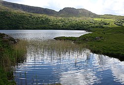 Uragh Wood Nature ReserveNature reserve · 1.1 mi
Explorer Tom Uragh Wood Nature Reserve in County bragged about surviving a storm so bad it shook the earth, but I think it just…
 Enclosure in Baurearagh (glanarought By., Banawn Ed)Enclosure · 1.2 mi
Explorer Tom Enclosure in Baurearagh inspired a terrible poem about its circular shape that nobody wants to read aloud. It’s…
 Uragh WoodForest · 1.2 mi
Explorer Tom Uragh Wood in County Kerry would tell the housing estate that replaced its neighbor it should have just admitted defeat…
 CahaMountain / peak · 1.9 mi
Explorer Tom Caha in County Kerry refuses to fall down because it thinks gravity is being personal about its waistline. It stands…
 Killane Mountain South-West TopMountain / peak · 1.9 mi
Explorer Tom Killane Mountain South-West Top has very strong opinions on modern building codes and hates that nobody respects its…
 Baurearagh MountainMountain / peak · 2.1 mi
Explorer Tom Baurearagh Mountain in County Kerry fooled the mapmakers into drawing it three kilometers away from where it actually…
 Anomalous stone group in Drombohilly LowerAnomalous stone group · 3.0 mi
Explorer Tom Anomalous stone group in Drombohilly Lower would review its visitors as 'adequate but damp'. It’s just four stones…
 Ormond's IslandIslet · 4.2 mi
Explorer Tom Ormond's Island brags about surviving a storm so huge it claimed the waves were actually giant whales trying to eat it.…
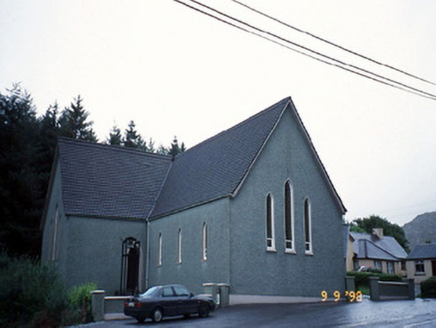 Saint Killian's Catholic ChurchChurch/chapel · 4.9 mi
Explorer Tom Saint Killian's Catholic Church in Derreen would complain to the council about the lack of parking for angels. It’s got…
More archaeology and monuments in County Kerry · All of County Kerry

What do you know about this place?Tap to add a comment or ask a question