
What is recorded here
From the National Monuments Service (Archaeological Survey of Ireland) record TS076-001002
Places near here
Photo credits
- National Inventory of Architectural Heritage
- Maker not stated on source page, www.pinterest.com
- Maker not stated on source page, en.wikipedia.org
- Mike Searle, Wikimedia Commons · CC BY-SA 2.0
- Maker not stated on source page, uk.pinterest.com
- Sarah777, transferred by Lvova, Wikimedia Commons · Public domain
- Martin Richard Phelan, Geograph · CC BY-SA 2.0
- Benutzer:StefanServos, Wikimedia Commons · CC BY-SA 3.0
 Outrath LodgeRectory/glebe/vicarage/curate's house · 1124 yd
Explorer Tom Outrath Lodge has a bird that refuses to leave the chimney, probably because it thinks it’s got a permanent job there.…
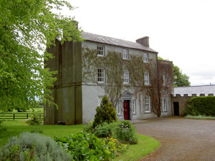 The GlebeRectory/glebe/vicarage/curate's house · 1759 yd
Explorer Tom The Glebe in Graigue handles a nosey neighbour by simply pretending not to be there, which works surprisingly well for…
 Kedrah Castle (in ruins)Castle, tower house · 1.4 mi
Explorer Tom Kedrah Castle would order a massive chipper with triple ketchup and extra gravy because it feels like it needs to bulk…
 Mortlestown GraveyardGraveyard · 1.5 mi
Explorer Tom Mortlestown Graveyard in County Tipperary would bring a bottle of very old wine and a story about a ghost that only…
 Fairy fort / earthen ringfort in RathardFairy fort / earthen ringfort · 1.5 mi
Explorer Tom Fairy fort / earthen ringfort in Rathard smells like wet dirt, old nettles, and the faint ghost of a bad decision from…
 Castle (in ruins)Castle, tower house · 1.7 mi
Explorer Tom Castle in Cloghabreedy has been hiding a massive scandal for centuries, and it involves a very rude hat that was never…
 Knockgraffon CastleCastle · 1.7 mi
Explorer Tom Knockgraffon Castle in County Tipperary has circular bartizans that look like they’re watching you with suspicion…
 Castle Coyne (in ruins)Castle, tower house · 1.8 mi
Explorer Tom Castle Coyne has very strong opinions about the road leading to it, thinking it’s too narrow for its own dignity. It’s…
 Knockgraffon MotteArchaeological place · 2.0 mi
Explorer Tom Knockgraffon Motte is furious because the map makers got its position completely wrong on the last survey. They put it…
 Knockgraffon MoatCastle, motte and bailey · 2.0 mi
Explorer Tom Knockgraffon Moat has a hidden treasure that is definitely just a biscuit tin from 1974. It was built in 1192, which…
 Cahir CastleCastle · 3.7 mi
Explorer Tom Cahir Castle's first owner planned to escape via a moat that was mostly just wet mud. It’s the ultimate 'I meant to do…
 Scaragh WoodForest · 6.3 mi
Explorer Tom Scaragh Wood in County Tipperary has had so many former names that it now just goes by 'The Thing With The Trees' to…
More archaeology and monuments in County Tipperary · All of County Tipperary

What do you know about this place?Tap to add a comment or ask a question