What is recorded here
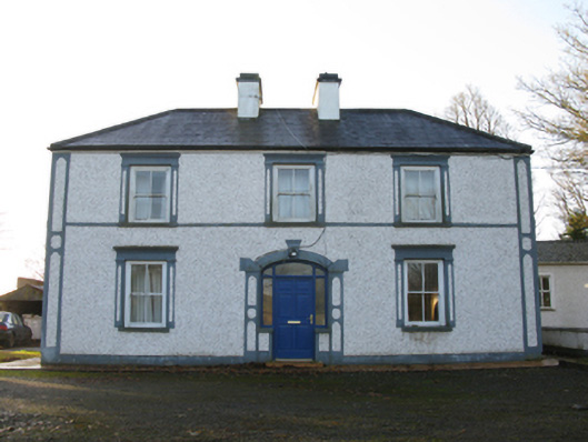
Detached three-bay two-storey farmhouse, post-1920, on a rectangular plan with three-bay two-storey rear (south) elevation. Hipped slate roof with clay ridge tiles centred on paired rendered chimney stacks having corbelled stepped stringcourses below capping supporting terracotta pots, and cast-iron rainwater goods on timber eaves boards retaining cast-iron downpipes. Gritdashed roughcast walls bellcast over rendered plinth with gritdashed roughcast-panelled rendered piers to ends. Hipped segmental-headed central door opening with timber mullions on tiled step threshold supporting timber transom, and rendered surround with gritdashed roughcast-panelled pilasters centred on keystone framing replacement timber panelled door having sidelights below overlight. Square-headed window openings with concrete sills, and rendered surrounds with gritdashed roughcast-panelled pilasters supporting dentilated cornices on blind friezes framing two-over-two timber sash windows having exposed sash boxes. Set in landscaped grounds.
A farmhouse representing an interesting component of the twentieth-century domestic built heritage of the outskirts of Aghamore with the architectural value of the composition confirmed by such attributes as the compact rectilinear plan form centred on an elegant doorcase; and the slight diminishing in scale of the openings on each floor producing a graduated visual impression with those openings showing mildly esoteric Classical refinements. Having been well maintained, the elementary form and massing survive intact together with substantial quantities of the historic or original fabric, thereby upholding the character or integrity of the composition. Furthermore, adjacent outbuildings, some most likely predating the present farmhouse, continue to contribute positively to the group and setting values of a neat self-contained ensemble making a pleasing visual statement in a rural street scene.
From the Buildings of Ireland (National Inventory of Architectural Heritage) record 31308109
This does not grant access. Most recorded buildings are privately owned; view them only from public ground unless the owner allows entry.
Places near here
IndicatedFairy fort / earthen ringfort · 474 yd Doogary National SchoolSchool · 1438 ydRogersHouse · 1.1 miT.j. RogersHouse · 1.1 miGrave YardGraveyard · 1.3 miEast Mayo Brigade MonumentMemorial · 2.0 miCastleCastle, unclassified · 3.7 miIndicatedHouse, fortified house · 3.7 miKnock ShrineHeritage attraction · 3.9 miCurlew MountainsMountain / peak · 22 miCaves of KeshCave · 23 miKesh CorannMountain / peak · 23 mi
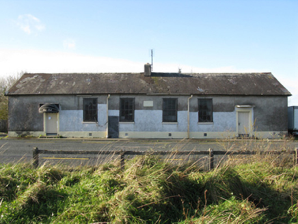 Doogary National SchoolSchool · 1438 yd
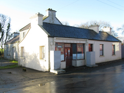 RogersHouse · 1.1 mi
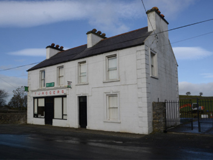 T.j. RogersHouse · 1.1 mi
 Grave YardGraveyard · 1.3 miEast Mayo Brigade MonumentMemorial · 2.0 mi
 CastleCastle, unclassified · 3.7 mi
 IndicatedHouse, fortified house · 3.7 mi
 Knock ShrineHeritage attraction · 3.9 mi
 Curlew MountainsMountain / peak · 22 mi
 Caves of KeshCave · 23 mi
 Kesh CorannMountain / peak · 23 mi
Pictures: National Inventory of Architectural Heritage; David Purchase, Geograph · Creative Commons Attribution-ShareAlike 2.0; Mike Searle, Geograph · CC BY-SA 2.0; Paul Cowan, Wikimedia Commons · CC BY-SA 2.0; Wikimedia Commons contributor · CC BY 2.5; Jon Sullivan, Wikimedia Commons · CC0; Oliver Dixon, Geograph · CC BY-SA 2.0
More historic places in County Mayo · All of County Mayo
What do you know about this place?