
What is recorded here
Detached three-bay single-storey lobby entry farmhouse with half-dormer attic, extant 1840, on a rectangular plan. Hipped slate roof with clay ridge tiles centred on cement rendered chimney stack having concrete capping supporting terracotta or yellow terracotta octagonal pots, and replacement uPVC rainwater goods on rendered eaves. Replacement cement rendered battered walls bellcast over rendered plinth. Square-headed central door opening with concrete threshold, and rendered surround with fluted pilasters supporting fluted archivolt centred on fluted keystone framing glazed timber panelled door. Square-headed window openings with concrete or rendered sills, and rendered "bas-relief" surrounds framing one-over-one timber sash windows. Set in landscaped grounds perpendicular to road with rendered piers to perimeter having lichen-spotted shallow pyramidal capping supporting iron double gates.
A house identified as an integral component of the vernacular heritage of south County Wexford by such attributes as the alignment perpendicular to the road; the compact rectilinear lobby entry plan form centred on a Classically-detailed doorcase; the construction in unrefined local materials displaying a pronounced battered silhouette; and the disproportionate bias of solid to void in the massing compounded by the diminishing in scale of the openings on each floor producing a graduated visual impression (cf. 15703316). Having been well maintained, the elementary form and massing survive intact together with quantities of the historic or original fabric, thus upholding the character or integrity of a farmhouse making a pleasing visual statement in a rural street scene.
This does not grant access. Most recorded buildings are privately owned; view them only from public ground unless the owner allows entry.
Places near here
 Castle (Site of)Castle, unclassified · 614 yd
 Enclosure in BrideswellEnclosure · 754 yd
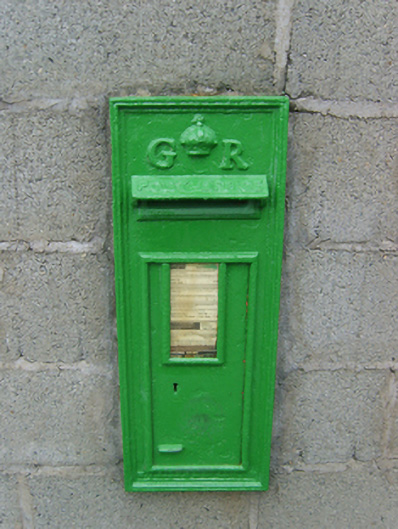 post boxpost box · 914 yd
 Brideswell Ho.Castle, unclassified · 982 yd
 Harpoonstown Housefarm house · 1284 yd
 Brides WellHoly well · 1333 yd
 The Heron's MeadowForest · 3.4 mi
 Carrickatinna RockMountain / peak · 3.4 mi
 The Bull RockForest · 3.4 mi
 Skeater RockMountain / peak · 3.5 mi
 1798 Memorial PlaqueMemorial · 3.6 mi
 Ballyhealy BeachBeach / strand · 4.6 mi
Other information
Photo: National Inventory of Architectural Heritage · Website use allowed for educational or private purposes with source credit