
What is recorded here
From the National Monuments Service (Archaeological Survey of Ireland) record WA023-004
Places near here
Photo credits
- Maker not stated on source page, www.pinterest.com
- Maker not stated on source page, en.wikipedia.org
- National Inventory of Architectural Heritage
- Maker not stated on source page, www.theirishplace.com
- Maker not stated on source page, uk.pinterest.com
- Stephan van Helden, Wikimedia Commons · CC BY-SA 4.0
- Maker not stated on source page, tr.pinterest.com
- Maker not stated on source page, ru.pinterest.com
- Denis O’Flynn / EchoLive, www.echolive.ie
 Standing stoneStanding stone, pair · 1.3 mi
Explorer Tom Stone row in Coumaraglinmountain used to be a pair, but one got fed up with the other. They are eleven metres apart…
 Standing stone in Bohadoon MountainStanding stone · 2.3 mi
Explorer Tom Standing stone in Bohadoon Mountain is named after Grey Dermot, a guy who apparently had a terrible tan and an even…
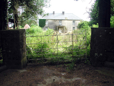 Castlequarter HouseHouse · 4.2 mi
Explorer Tom Castlequarter House saw a love story end badly when someone threw a shoe at the chimney. It’s been renovated until it…
 Seskinans Church (in ruins)Church · 4.3 mi
Explorer Tom Seskinans Church is derelict enough to have an imaginary twin across the sea that sends it postcards. It sits on level…
 Knockboy GraveyardGraveyard · 4.3 mi
Explorer Tom Knockboy Graveyard took about forty thousand cups of tea to build, mostly because the builders kept stopping to…
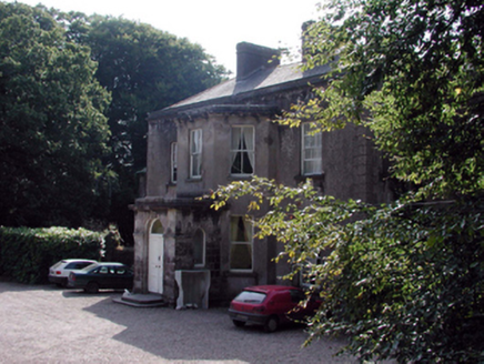 CloncoskraineHouse · 4.6 mi
Explorer Tom Cloncoskraine in Knockahavaun is where a fiddler played all night until the sun came up and the cows started dancing!…
 Horse-chestnut4.7 mi
Explorer Tom Horse-chestnut in County Waterford is sick of being asked if its fruits are actually edible, especially when they taste…
 Fairy fort / earthen ringfort in KilcooneyFairy fort / earthen ringfort · 4.9 mi
Explorer Tom Fairy fort in Kilcooney has an imaginary twin across the sea that it talks to during thunderstorms. The bank is thick…
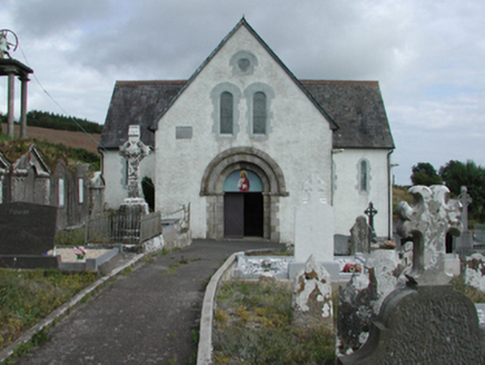 Saint Gobnait's Catholic ChurchChurch/chapel · 4.9 mi
Explorer Tom Saint Gobnait's Catholic Church (Kilgobnet) would cope on a reality show by hiding in its cruciform shadow and refusing…
 Kilgobnet CemeteryGraveyard · 4.9 mi
Explorer Tom Kilgobnet Cemetery is named after a giant gob of net that got stuck on the hill, which is definitely not true but…
 Ballylemon WoodForest · 6.2 mi
Explorer Tom Ballylemon Wood in County Waterford has a prophecy that says it will float away on a Tuesday, which has never happened…
 Castlemartyr GAA pitchGAA ground · 27 mi
More archaeology and monuments in County Waterford · All of County Waterford

What do you know about this place?Tap to add a comment or ask a question