What is recorded here
Thirty metres of forgotten wall still bulge through the grass at Renny Lower, though ploughs and time have rubbed the fort flat. The southern gap remains wide enough for a cart, hinting that the entrance never fully closed even after the stones surrendered to soil. Cows graze the ridge now, treating human history as mere texture beneath their hooves.
In pasture, on SW-facing slope, c. 250m NE of River Blackwater. Depicted on 1935 OS 6-inch map as hachured penannular enclosure SW->E. Levelled; roughly circular area (30m E-W; 28m N-S) enclosed by low grass-covered rise (H 0.3m) S->SSE. Break (Wth 12m) to SSE may be remains of entrance. Enclosure (CO034-03102-) lies 30m to E in adjoining field.
The above description is derived from the published 'Archaeological Inventory of County Cork. Volume 4: North Cork' (Dublin: Stationery Office, 2000). In certain instances the entries have been revised and updated in the light of recent research.
Date of upload/revision: 14 January 2009
A fairy fort / earthen ringfort in Renny Lower is a roughly circular, low-lying earthwork enclosure, likely an early-medieval ringfort used for habitation or defence. It is associated with local folklore surrounding fairy realms and otherworldly beings, common in Irish and Scottish traditions.
The monument record does not grant public access. Check the route and ask the landowner before entering private land.
- What survives
- Recorded monument
Places near here
 BarrowBarrow, ring-barrow · 84 yd
 Castle (in Ruins)Castle, unclassified · 390 yd
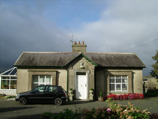 Convamoregate lodge · 515 yd
 Woodvillecountry house · 644 yd
 IcehouseIcehouse · 890 yd
 Blackwater (Avondhu) WayWalking route · 1151 yd
 Priest's WoodForest · 1716 yd
 Johnson's WoodForest · 1.3 mi
 Ballyhooly CastleCastle · 1.4 mi
 Knocknaskagh North TopMountain / peak · 1.9 mi
 Liam BurkeMemorial · 2.6 mi
 SeefinMountain / peak · 3.4 mi