What is recorded here
Three deep ditches and four heavy banks still circle Rathdrumin, marking a place where human hands shaped the earth into a maze for fairies or kings. The grassy ridges rise and fall like the ribs of a buried beast, inviting a person to imagine chambers hidden beneath the soil. What is certain is the scale of the work and the patience required to build it.
The following description is derived from both the published 'Archaeological Inventory of County Louth' (Dublin: Stationery Office, 1986) and the 'Archaeological Survey of County Louth' (Dublin: Stationery Office, 1991). In certain instances the entries have been revised and updated in the light of recent research.
Date of upload/revision: 17 July 2007
Circular area (int. diam. 52m) enclosed by three substantial earth and stone banks with two intervening fosses. Inner bank (Wth 8.3-13m, H 1-2.1m internally, 2.6-4.6m externally). Inner fosse (Wth 10m, D 3m) enclosed by middle banks (Wth 4.5m, H 3m) and outer fosse (Wth 10m, D 4m). The outer bank (Wth 2m, H 0.5m externally) is best preserved on W and S and is interfered with by modern field fences on N, E and SE. Original entrance may be at E but is heavily modified by modern activity. Possible Man-made underground passage (LH018-045002-) at site.
This monument is subject to a preservation order made under the National Monuments Acts 1930 to 2014 (PO no. 3/1971).
The monument record does not grant public access. Check the route and ask the landowner before entering private land.
- What survives
- Recorded monument
Places near here
 Church (Disused)Church · 322 yd
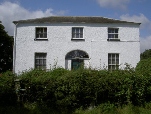 Glebe Houserectory/glebe/vicarage/curate's house · 434 yd
 Chapel (in Ruins), GraveyardChurch · 1086 yd
 Enclosure in RinkinstownEnclosure · 1287 yd
 Moneyveg WoodForest · 1294 yd
 Holy well in CarrickbaggotHoly well · 1523 yd
 Sweet baySweet bay · 1.1 mi
 BarmeathCastle, tower house · 1.2 mi
 Graveyard in DysartGraveyard · 1.2 mi
 Tullydonnell HillMountain / peak · 2.2 mi
 CastleCastle, unclassified · 2.2 mi
 MonasterboiceEarly monastic site · 4.7 mi