What is recorded here
Half a kilometre of grass and memory separates the fort from water, yet the lough still touches the place through rain, shadow and story. The fort stands on a drumlin like a chair pulled up to the edge of the world, its earthen bank wide enough to carry a person and high enough to keep a promise. What was hidden there is no longer written in stone, but the shape still points downward, toward the lake and whatever the lake remembers.
Located on the summit of a prominent drumlin overlooking the N, bulbous (dims c. 330-c. 400m) end of Rahans Lough (L c. 1km N-S), which is c. 330m to the ESE. This is a circular overgrown area (diam. c. 50m) sloping down to the S, which is defined by an overgrown earthen bank (at SE: Wth 5.4m; int. H 1.3m; ext. H 2.5m) and an overgrown fosse (at SE: Wth of top 3.8m; Wth of base 1.8m; ext. D 0.75m), with traces of an outer bank at W and N. The entrance (Wth 2.45m) and causeway (Wth 3m; H 1m) are at SE.
The above description is derived from the published 'Archaeological Inventory of County Monaghan' (Dublin: Stationery Office, 1986). In certain instances the entries have been revised and updated in the light of recent research.
Date of revision: 17 June 2017
The monument record does not grant public access. Check the route and ask the landowner before entering private land.
- What survives
- Recorded monument
Places near here
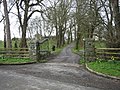 IndicatedCrannog · 614 yd
 Crannog in DrumboCrannog · 690 yd
 Descart Housefarmyard complex · 1075 yd
 spa wellspa well · 1342 yd
 BarleyhillMountain / peak · 1.4 mi
 Tree IslandWood · 2.0 mi
 Natural Play AreaMemorial · 2.2 mi
 In Memory of Our DadMemorial · 2.3 mi
 Dún a Rí Forest ParkForest · 2.4 mi
 Castle ruinsCastle, unclassified · 2.4 mi
 CabraMountain / peak · 2.4 mi
 Lagan castleCastle, tower house · 3.1 mi