What is recorded here
Fairy fort in Moatfarrell is a 48.2-metre earthen ring on a SW-facing pasture slope, partly banked and partly scarped, with its entrance lost to time. Cattle graze where people once drew a line around their own lives, and the flattened eastern bank suggests that line was forgotten before it was broken. The shape remains because soil remembers pressure, even when human memory stops paying attention.
On a SW-facing slope in pasture. A raised circular area (diam. 48.2m) enclosed by a low bank of earth and stone (Wth 3.9m; H 1.2m) from SW-WSW-W and by a steep scarp (H 0.2-3.3m) from W-N-NE. From NE-E-SW the bank has been levelled but its outline is still identifiable. There is no trace of a fosse and the original entrance is not recognisable.
Compiled by: Patrick F. O'Donovan
Date of upload: 26 August 2011
This remains an important historical record, but the official description says the monument is no longer visible or has been destroyed. The monument record does not grant public access. Check the route and ask the landowner before entering private land.
- What survives
- No visible remains or recorded as destroyed
Places near here
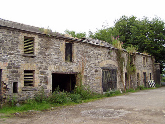 Moatfarrell Houseoutbuilding · 265 yd
 IndicatedBawn · 426 yd
 Field system in MoatfarrellField system · 438 yd
 Moat & CastleCastle, motte and bailey · 478 yd
 Castle (in Ruins)House, 18th/19th century · 540 yd
 Ecclesiastical enclosure in MoatfarrellEcclesiastical enclosure · 550 yd
 Edgeworthstown BypassMemorial · 2.6 mi
 Oldtown DemesneForest · 2.8 mi
 Oldtown CopseWood · 2.9 mi
 Clonfin Ambush MemorialMemorial · 3.6 mi
 Bully's Acregraveyard/cemetery, unknown · 3.7 mi
 National Famine WayWalking route · 6.6 mi