What is recorded here
Fairy fort / earthen ringfort in Kilballyherberry, Garraun (Ballysheehan parish) is a fairy fort or earthen ringfort in Kilballyherberry, Garraun (Ballysheehan parish), County Tipperary, Ireland. It occupies a hilltop with panoramic views in all directions. A townland boundary cuts the site from northwest to southeast. Only the northern part survives, forming a semi-circular area about 27 metres north-south and 50 metres east-west.
On a hilltop with good panoramic views in all directions. Townland boundary bisects ringfort on a NW-SE axis as indicated on latest ed. OS 6-inch map. No surface remains visible of enclosing element SW of the townland boundary. Only the N portion of the ringfort survives. The monument consists of a semi-circular area (diam. 27m N-S; c. 50m E-W) enclosed by an earth and stone bank (top Wth 1.4m; base Wth 2.2m; int. H 0.3m; ext. H 0.4m) visible from NW through N to SE only. Internal diameter from NW to SE unobtainable due to dense cover of vegetation. On first ed. OS 6-inch map the monument is depicted as a semi-circular earthwork with no enclosing element depicted on S side of townland boundary, however, the 2nd (1953-4) ed. depicts a completely sub-circular enclosure, which is also shown on a sketch plan and sections drawn in 1954 (overall dims. 254ft [c. 77m] N-S; 202ft [c. 61.5m] E-W) (OS Field Memorandums).
Compiled by: Jean Farrelly
Date of upload: 26 August 2011
The monument record does not grant public access. Check the route and ask the landowner before entering private land.
- What survives
- Recorded monument
Places near here
 Taylor's WoodWood · 1143 yd
 IndicatedFairy fort / earthen ringfort · 1398 yd
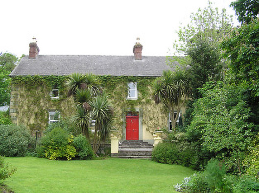 Derrynaflan Househouse · 1.0 mi
 Ballinure HillMountain / peak · 1.1 mi
 Hilltop enclosure in Ballaghboy (graystown Par.)Hilltop enclosure · 1.1 mi
 Noan WoodWood · 1.1 mi
 Church in RuinsChurch · 1.2 mi
 Castle in RuinsCastle, motte and bailey · 1.4 mi
 The GarrisonCastle, tower house · 1.4 mi
 Gobban Saer's GraveArchaeological place · 3.9 mi
 Ballyknock HillMountain / peak · 4.2 mi
 Horse and JockeyVisitor information · 4.6 mi