What is recorded here
A modern roadway splits the oval rath in Glebe, hiding half the ancient earthworks beneath pasture and noise. The remaining bank still stands on a gentle slope, marked by quarry holes and a causeway that may have guided people into the center. Two underground passages wait inside, preserving a depth the surface no longer shows.
On a gentle SSE-facing slope in pasture. A raised oval area (c. 60m ENE-WSW; 43.2m NNW-SSE) enclosed by a much-denuded, low bank of earth and stone (Wth 5.4m; H 0.4m max.) with a shallow external fosse (Wth 4m; D 0.3m) and an outer bank (Wth 4.8m; H 0.6m). Quarry holes are evident in both banks and a relatively modern farm building has been built into the outer bank at SSW. A modern NNW-SSE roadway divides the rath into unequal portions. The smaller portion, to the ENE, has been levelled and is not visible at ground level. Corresponding breaks (Wth 2.4m) in the banks at NNW with an accompanying causeway may mark the original entrance. There are two Man-made underground passages (LF021-039002-; LF021-039003-) within the interior.
Compiled by: Patrick F. O'Donovan
Date of upload: 26 August 2011
The monument record does not grant public access. Check the route and ask the landowner before entering private land.
- What survives
- Recorded monument
Places near here
 Man-made underground passage in Aghavadden,glebe (rathcline By., Cashel West Ed)Man-made underground passage · 31 yd
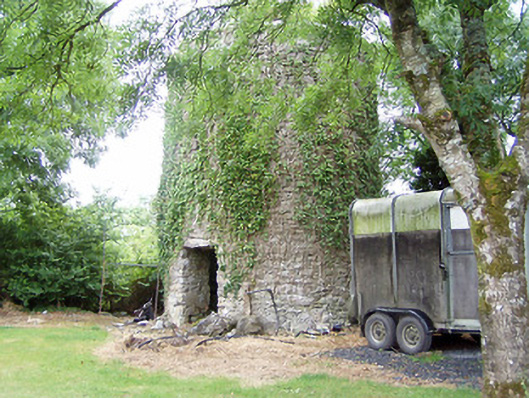 mill (wind)mill (wind) · 877 yd
 Church (in Ruins)Church · 1252 yd
 Grave YardGraveyard · 1271 yd
 Caltragh CastleCastle, unclassified · 1511 yd
 Elfeet CastleCastle, Anglo-Norman masonry castle · 1648 yd
 Priest's IslandIslet · 1.4 mi
 Culnagore WoodForest · 1.4 mi
 Elfeet BayBay · 1.5 mi
 Leveran IslandIslet · 1.6 mi
 Black RockNamed rock · 3.2 mi
 St. John's WoodWood · 3.2 mi