What is recorded here
Fairy fort / earthen ringfort in Garranlea is a fairy fort or earthen ringfort in Garranlea, County Tipperary, Ireland. It occupies a roughly oval pasture area measuring about 30 metres north to south and 26 metres east to west on a gentle southwest-facing slope. An earthen scarp runs northeast through south to west and northwest, while a wider bank and collapsed rubble stone wall complete the northwest, north and northeast boundary. Mature thorn and chestnut trees surround the scarp, and the interior slopes downward to the southwest beneath mature thorn trees.
In pasture, on a gentle SW-facing slope. Roughly oval area (dims. c. 30m N-S; c. 26m E-W) defined by earthen scarp (Wth c. 4m; H 1.45m) NE-S-W-NW and bank (Wth c. 6m; int. H 1.15m; ext. H 0.65m) and collapsed rubble stone wall NW-N-NE. Mature thorn and some chestnut trees around scarp. Interior slopes down to SW and is covered in mature thorn trees. Ringfort (TS068-084----) is c. 270m to SE.
Compiled by: Jean Farrelly
Date of upload: 26 August 2011
The monument record does not grant public access. Check the route and ask the landowner before entering private land.
- What survives
- Recorded monument
Places near here
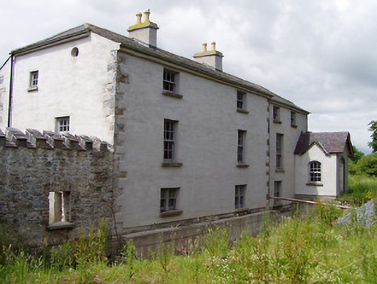 Mill Housemill (water) · 181 yd
 Hymenstownhouse · 722 yd
 Ecclesiastical enclosure in MasterstownEcclesiastical enclosure · 833 yd
 Bawn in GarranleaBawn · 998 yd
 Enclosure in Lagganstown LowerEnclosure · 1523 yd
 Boytonrath Castle (in ruins)Castle, unclassified · 1.0 mi
 Athassel PrioryHeritage attraction · 2.9 mi
 Caucasian zelkovaCaucasian zelkova · 3.5 mi
 Cappa WoodWood · 4.2 mi
 Slieveanard NE TopMountain / peak · 4.7 mi
 Caher AbbeyHeritage attraction · 4.8 mi
 Siege of Cahir Castlesiege · 5.0 mi