What is recorded here
Yes. An oval earthen ring sits at the SE end of a drumlin ridge in County Monaghan, its grass-covered bank and shallow outer ditch still marking a place people shaped before written memory. The fairies may have taken the name, but the measurements belong to human hands: a broad entrance gap at SE, a steepened scarp at NNW, and a perimeter large enough for living, keeping, or gathering. It is not a fantasy castle; it is a old boundary made visible, waiting to be read rather than feared.
Located towards the SE end of a NW-SE drumlin ridge. This is an oval grass-covered area (dims 47m E-W; 40.8m N-S) defined by an overgrown earthen bank (at SSE: Wth 6.2m; int. H 0.8m; ext. H 2.8m) SE-E that is reduced to a scarp (at NNW: Wth 7m; H 4m) elsewhere, with an outer fosse (Wth of top 4.8m; Wth of base 2.2m; ext. D 0.2m) E-S, which might be obscured by field banks outside the perimeter elsewhere. There is an entrance gap (Wth of base 2.5m) at SE, which might be the original entrance
The above description is derived from the published 'Archaeological Inventory of County Monaghan' (Dublin: Stationery Office, 1986). In certain instances the entries have been revised and updated in the light of recent research.
Date of revision: 6 December 2017
The monument record does not grant public access. Check the route and ask the landowner before entering private land.
- What survives
- Recorded monument
Places near here
 Fairy fort / earthen ringfort in AghateskinFairy fort / earthen ringfort · 1619 yd
 Enclosure in Lisnamoyle EtraEnclosure · 1.0 mi
 Saint Patrick's Catholic Churchchurch/chapel · 1.1 mi
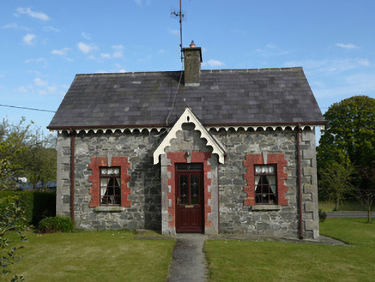 worker's houseworker's house · 1.1 mi
 KnockreaghMountain / peak · 1.4 mi
 TobernagalliaghSpring · 2.2 mi
 Mannan Castle (in ruins)Castle, Anglo-Norman masonry castle · 2.3 mi
 Fincarn HillMountain / peak · 2.9 mi
 Whites IslandIslet · 3.9 mi
 Gully IslandIslet · 4.2 mi
 Horse-chestnutHorse-chestnut · 4.7 mi
 Battle of Newry Roadbattle · 4.9 mi