What is recorded here
Fairy forts are human homes, farmyards and refuse pits misnamed later. Crumlin’s ringfort is a 35m earthen chamber on a Monaghan spur, with a narrow SE causeway, a deep southern fosse and an outer bank still visible through grass. It may have held a family, a herdsman or a seasonal craftsman; the fairies came later, filling the forgotten shape with wonder.
Situated on the crest of and towards the bottom of a NW-SE spur. This is an overgrown circular area (diam. 35m E-W) defined by an overgrown earthen bank (at N: Wth of base 6m; int. H 0.7m; ext. H 3.8m) largely reduced to a scarp (at S: Wth 6.6m; H 3.8m) and fosse (at S: Wth of top 11m; ext. D 1.6m) with an outer bank best preserved (at S: Wth of base 5m; ext. H 1.6m) S-W-NE and is largely absent elsewhere where it may have been pushed into the fosse. The original entrance (Wth at base 1.4m) and causeway (H 0.6m) is at SE. The interior is bisected by an ENE-WSW field bank and drain.
The above description is derived from the published 'Archaeological Inventory of County Monaghan' (Dublin: Stationery Office, 1986). In certain instances the entries have been revised and updated in the light of recent research.
Date of revision: 28 June 2017
The monument record does not grant public access. Check the route and ask the landowner before entering private land.
- What survives
- Recorded monument
Places near here
 Drumerlough MoreMountain / peak · 1517 yd
 Giants GraveArchaeological place · 1.0 mi
 Horse-chestnutHorse-chestnut · 1.1 mi
 Mass-rock in Camaghy,tonaneeveMass-rock · 1.1 mi
 The Gleberectory/glebe/vicarage/curate's house · 1.2 mi
 Chruch YardGraveyard · 1.2 mi
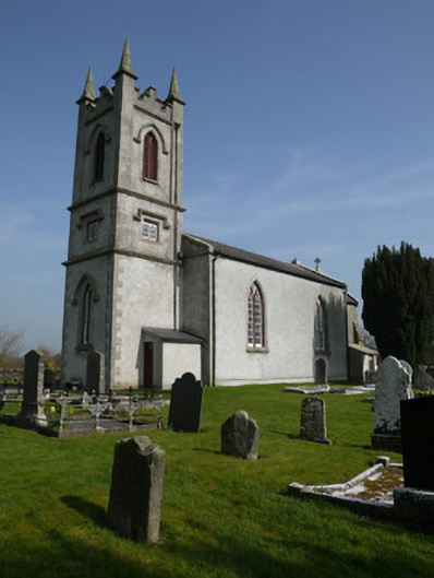 Saint Molua's Church (Magheracloone)church/chapel · 1.2 mi
 Castle ruinsCastle, unclassified · 1.3 mi
 In Memory of Our DadMemorial · 1.4 mi
 Dún a Rí Forest ParkForest · 1.5 mi
 CabraMountain / peak · 1.6 mi
 Castle in ruinsCastle, unclassified · 2.8 mi