What is recorded here
Fairy fort / earthen ringfort in Coolatoor is a fairy fort or earthen ringfort in Coolatoor, County Westmeath, Ireland. The site is situated on gently sloping ground in pasture to the south of a farmhouse and farmyard, approximately 100 metres southwest of a nearby ringfort. The 1837 edition of the Ordnance Survey 6-inch map depicts the monument as a tree-planted rectangular-shaped earthwork with rounded corners, while the 1910 edition of the Ordnance Survey 25-inch map records it as a subcircular-shaped earthwork. A 1973 account describes the site as a roughly circular-shaped area defined by a scarp and a stone retaining wall at the east, noting that access to the interior was difficult due to stacks of recently felled trees and overgrowth.
Situated on gently sloping ground, in pasture, to S of a farmhouse and farmyard. Ringfort (WM031-016----) lies c. 100m to NW. Depicted on the 1837 ed. OS 6-inch map as a tree-planted rectangular-shaped earthwork with rounded corners. Depicted on the 1910 ed. OS 25-inch map as a subcircular-shaped earthwork. Monument described in 1973 as a roughly circular-shaped area defined by a scarp and a stone retaining wall at E. Access is difficult in the interior due to stacks of recently felled trees and overgrowth. Monument is visible today as a roughly oval-shaped tree-planted earthwork on Digital Globe aerial photography.
Compiled by Alison McQueen, Vera Rahilly and Caimin O’Brien.
Date of upload: 12 November 2019
The monument record does not grant public access. Check the route and ask the landowner before entering private land.
- What survives
- Recorded monument
Places near here
 KnockastiaMountain / peak · 904 yd
 OutlinedFairy fort / earthen ringfort · 907 yd
 Partially indicatedEnclosure · 982 yd
 Ancient Chapel (in Ruins)Church · 1331 yd
 Bishopstown Castle in ruinsCastle, unclassified · 1415 yd
 Japanese pagoda treeJapanese pagoda tree · 1577 yd
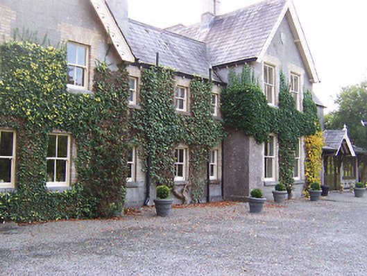 Coolatoor Househouse · 1591 yd
 CastleCastle, unclassified · 1.3 mi
 Sam's ParkForest · 1.4 mi
 Kilmalady HillMountain / peak · 4.8 mi
 Charles BianconiMemorial · 5.3 mi
 The Bob Traynor GalleryGallery · 5.4 mi